SHALLOW LAKE hike & canoeing
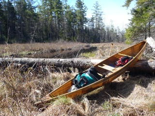
Apr 29&30, 2012 - SHALLOW LAKE & SUCKER BROOK canoe camping. Pigeon Lake Wilderness Area. 1.3 mile carry from Lower Browns Tract Pond. Trail rough at first then got worse as it got wet & muddy passing thru swamp on either side of Beaver Brook. Bridge over the latter has bouncy 3 log stringers at water level. Paddled down the brook half mile to large boggy area. Last 0.9 miles of trail better but not without its muddy spots. Aluminum canoe at the end of the trail. Very windy with waves over 1'. Paddled around E end & settled into an excellent campsite amongst white pines with a long rocky point & commanding view of the lake. 4 hours from the start & the partying began. There are at least 3 other campsites on the lake (did not like 2 of those). Great wilderness feel, very quiet. Wind finally died down in the evening - the next day was much calmer - temp dropped into the 20s overnight. Paddled down Sucker Brook the outlet for half an hour portaging around one downed tree & turned around when I saw 3 more blockages ahead. Paddled up Sucker Brook the inlet for half an hour sliding over a couple of small beaver dams, could have gone further. Loon, mallard & gull pairs; kingfisher, white-throated sparrows, pileated woodpecker, yellowlegs, barred owl, grouse, beaver. No bad bugs.
Mon Sep 19, 2005 - SHALLOW LAKE. Pigeon Lake Wilderness Area. Put in next to outlet of Lower Browns Tract Pond on Uncas Rd (mostly dirt) near Raquette Lake Village. Crossed the pond passing an interesting pine-topped island with rocky W end & cliffs on N side. At W end of state campsite (site 69), picked up the yellow trail which leads 0.2 miles to an old road. Jog L then R onto the yellow Shallow Lake Trail which is rough at first then goes thru a muddy spruce bog, crosses a 3 log bridge that is almost underwater. 2nd half of trail is better & I finish the carry from Lower Pond in 40 min. Shallow is a gem of a wilderness lake, only a mile long but with a varied shoreline for exploration. Paddled W on 30' wide Sucker Brook for ~1.5 mi. before narrowing & reaching a beaver dam which I went over but then a log blocked the way - tamarack & black spruce dominate, white pines' needles are yellowing (I think due to higher than normal water because of a beaver dam on the outlet which I was able to paddle down ~0.25 mi.). Smooth rocks on N shore make for nice spots to sun oneself & the rocky point is interesting. There are some campsites that are reachable only with boat. On return, took the old road S 0.3 mi. (easier walking) then a path to Lower Pond & put in on a sloping rock. 7 mi. paddling, 3 mi. carry, 7 hrs. Bell Bucktail, a 12' open kayak/pack canoe - at 18 lbs a breeze to carry.


Comments
Post a Comment