Posts

Showing posts with the label Oswegatchie River

THE BEST WEEK-LONG PADDLING TRIP IN THE ADIRONDACKS
Image
We are lucky to have many scenic lakes, ponds and other waterways in the Adirondacks that are available for us to paddle. However, it is not so easy for the tripper to find a true wilderness route in the Adirondacks of over 50 miles – one that is essentially motorless, does not cross any paved roads, and has minimal sights and sounds of civilization. Paddlers have traveled far and wide to places like Ontario's Algonquin Provincial Park and Minnesota's Boundary Waters to get that wilderness tripping experience. The Adirondack Park does not have the quantity of routes that those places offer but it does offer areas of superior scenic quality, especially when it comes to mountain views. The trip from Little Tupper Lake to the Oswegatchie River via Lake Lila and Lows Lake qualifies as the Adirondacks' best paddling route. Paddlers with less time or energy can sample parts of this route. For day-trippers and weekenders, Little Tupper Lake, Lake Lila, Lows Lake and the Osw...

LAKE LILA>LOWS LAKE>OSWEGATCHIE RIVER thru trip.

Image
A trip from Little Tupper lake thru to Inlet on the Oswegatchie River is arguably the best tripping route in the Adirondacks - I did Little Tupper to Lila soon after the area opened up to the public. Aug 31-Sep 7, 2008 - LAKE LILA>LOWS LAKE>OSWEGATCHIE RIVER. 5 miles of carries. Light fly & mosquito activity; latter more active for an hour after sunset. Misty mornings on the lakes. Seems like late morning each day there was noise from military training flights. Bell Northstar, 16.5' tandem canoe; Swift Kipawa, 16.5' tandem canoe; Bell Bucktail, 12' pack canoe. Aug 31, 2008 - LAKE LILA. 0.3 mile carry to the lake. A group was just leaving campsite on Canada Island & we move in. Box privy (aka "thunderbox"), sandy beach, large smooth rocks. Paddled up Shingle Shanty Brook, 3 beaver dams, new signs at carry & edge of state land warn canoes/kayak to stay out. Bald eagles. 4 barred owls hooted away in the evening. Sep 1 - LAKE LILA t...

OSWEGATCHIE RIVER canoe camping

Image
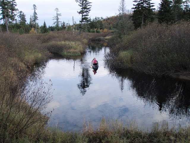
Sep 26, 2015 - OSWEGATCHIE RIVER upstream from the end of Inlet Rd in Fine. Five Ponds Wilderness Area. Water level low. Soon arrived at shallow rocky area, Bee Bee Rapid - best route close to shore on river L (on the R going upstream) then a breached beaver dam. Bear paw prints in the sand at Sam's Curve. Straight of the Woods. 3.6 miles to High Rock, nice view from 25' above the river. Griffin Rapids (not really rapids) in front of lean-to (site 38) - at top of rapids a shallow rocky section in front of site 37 was lined by some. Cage Lake Springhole (aka Buck Brook) Lean-to at 6.7 miles. Alders for a while then shores are high & treed - beautiful. Lined up Round Hill Rapids to footbridge (can also do a short carry on river L thru site 23). 10 miles & 6+! hours to campsite #22, the site of Walter Moore's (lumber) Camp, just past the footbridge. Sunny with temp in 60's. Sep 27 - BIG SHALLOW POND hike, one of the 5 Ponds. The trail roughly parallels Wolf Cree...