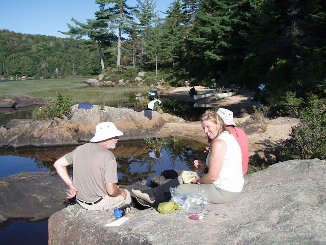
LAKE LILA>LOWS LAKE>OSWEGATCHIE RIVER thru trip.
A trip from Little Tupper lake thru to Inlet on the Oswegatchie River is arguably the best tripping route in the Adirondacks - I did Little Tupper to Lila soon after the area opened up to the public.
Aug 31-Sep 7, 2008 - LAKE LILA>LOWS LAKE>OSWEGATCHIE RIVER. 5 miles of carries. Light fly & mosquito activity; latter more active for an hour after sunset. Misty mornings on the lakes. Seems like late morning each day there was noise from military training flights. Bell Northstar, 16.5' tandem canoe; Swift Kipawa, 16.5' tandem canoe; Bell Bucktail, 12' pack canoe.
Aug 31, 2008 - LAKE LILA. 0.3 mile carry to the lake. A group was just leaving campsite on Canada Island & we move in. Box privy (aka "thunderbox"), sandy beach, large smooth rocks. Paddled up Shingle Shanty Brook, 3 beaver dams, new signs at carry & edge of state land warn canoes/kayak to stay out. Bald eagles. 4 barred owls hooted away in the evening.
Sep 1 - LAKE LILA to CLEAR POND. Paddled short distance & landed just W of Harrington Brook. Ribbons mark the rough 0.3-mile carry to flatwater. Up the brook & into shallow lilypad-filled Harrington Pond. Back a bit & up Rainer Brook for over a mile going over 3 beaver dams. Back down to railroad tracks. Carried E along tracks for 0.5 miles then left on 0.4 mile trail marked with yellow canoe carry discs to Clear Pond. 2 of us paddled to check out the campsite & go for a swim. 3 loons (1 chick). Back at the carry, 2 of the group had not yet arrived. After 3 hours we find them - they had continued on the tracks past the well-marked L turn & added 3 or 4 miles to their carry! Lousy steep landing at campsite, not much of a view but it had plenty of room for a few tents & did have a box privy. Some traffic on dirt road to N of pond, believe there is logging going on to the W. Coyotes across pond at night. Carries shown on Adirondack Paddlers Map 2nd Edition & in the book Adirondack Paddlers Guide by Cilley - not in older maps & guidebooks.
Sep 2 - CLEAR POND to LOWS LAKE. Carried directly from campsite N to dirt road, L for a short distance then R on an older dirt road (closed to vehicles) to landing on Bog Lake. The campsite nearby is nice. Paddled around W end of lake then down the outlet. Bald eagle flies overhead; lots of C geese in outlet (Bog River). Out onto Lows, we take the sneak route to E of the bog & look for a campsite on N of lake. Settle on #26 - squeeze in 4 tents near the water, box privy, view across bay to eagle's nest, Grassy Pond Mtn, view S across lake from lookout. Shallow sandy bottom good for swimming out to island. Sunset paddle. Lots of loons.
Sep 3 - LOWS LAKE, GRASS POND MTN. Hike up to the open rock on GP Mtn very well marked with ribbons, steep but takes less than an hour to viewpoint (see Discover Northwestern Adirondacks). Walked W of main viewpoint to where I could see Grassy Pond, bald eagle, ravens & hear loon calls. Lay my head down on small rock cairn - everything was just right - Nirvana! Swam, relaxed in camp. Sunset paddle. After dark could see flashes of lightning to the SE; above our heads nothing but stars & milky way.
Sep 4 - LOWS LAKE to OSWEGATCHIE RIVER. 0.8 mile carry from Lows to Big Deer Pond fairly smooth, one short steep hill some beaver flooding near end - took 20 mins. Moose footprint. 3 loons. Blue ribbons marked the start of 2.2 mile Headwaters Carry to the O. Mostly smooth & flattish. Crossing on an old beaver dam, then mailbox with register, then moderate uphill, downhill, then mostly smooth & flat, last section a bit rougher thru area highly impacted by 1995 blowdown. Lots of piles of bear scat in trail. Lows to O in under 3 hours. We work our way downstream for 5 miles going over many beaver dams & log obstructions (on one we had to remove packs from canoes to get over the tree). Stopped to look at most campsites - most good for 1 or 2 tents. Ended up at Camp Johnny #11, room for our 4 tents, rock overlooking river, only campsite of trip with no privy.
Sep 5 - CAMP JOHNNY to HIGH FALLS. 2 miles, more dams, obstructions. As we arrive at top of falls we surprise a naked guy with hands raised to the sky. His group was in the leanto to river R. Leanto on river L was open & we moved in - forecast was for rain 9/6 - my Cobra VHF/weather radio picked up channel 5. No view of falls from leanto but paths lead to open rocks both above & below falls - great spots to hang out.
Sep 6 - HIGH FALLS. A day of rest. Firewood scarce around leanto, had to paddle downstream to find some. Swam in pool below falls.
Sep 7 - HIGH FALLS to INLET. Showers had raised water level a few inches. 13 miles in 5 hours incl. rest stops at Cage Lake Springhole/Buck Brook leanto & High Rock. Very pleasant scenic paddle; any beaver dams were runnable without having to get out of the canoe.


Comments
Post a Comment