Posts

Showing posts from 2022

AIKEN WILDERNESS xc skiing & hiking near Woodford VT

Image
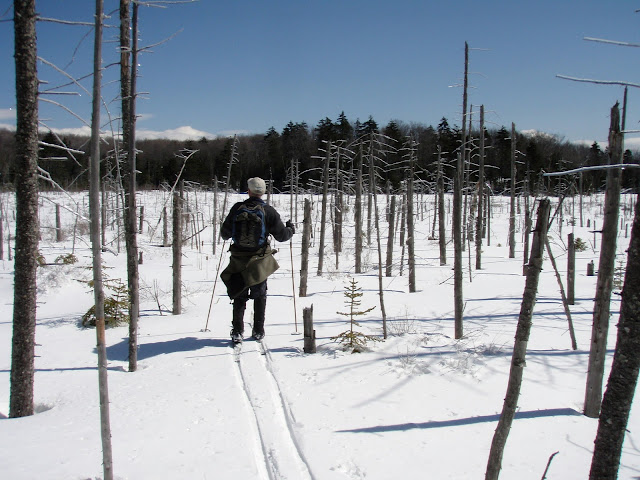
  Jan 2, 2017 - AIKEN WILDERNESS ski, southern Green Mtn NF.  Woodford State Park.  Across Adams Reservoir.  Path behind campsite 64 down to & across 3 beaver meadows/ponds.  No official signs or trail markers in the wilderness.  L on Old Dewey Road to Tin Can Junction - 2 moose passed thru here very recently judging by the fresh tracks.  Bushwhack W to Beaver Meadows, headwaters of the W Br Deerfield River.  Downstream thru beaver ponds - some thin ice.  Bushwhack W into the woods to trail to W edge of the wilderness area.  Excellent skiing on close to 2' of snow.  Elevation 2,300'-2,500'.  8.7 miles, 6 hours. Oct 10, 2016 - AIKEN WILDERNESS hike, from Woodford State Park, VT.  Took the Reservoir Loop Trail on W side of Adams Reservoir.  S of the reservoir took a R on unmarked rocky path at a 4-way intersection.  Soon at a beaver meadow.  Followed its edge, crossed stream in the woods to a small meadow then around a beaver pond to the Old Dewey Road in the wilderness a

Hiking THE PINNACLE & BRADLEY'S LOOKOUT

Image
  Aug 1, 2023 - A cooler, less humid day. First stopped at the Bolton Conservation Park & its lily pad-filled pond with a view of The Pinnacle. Took the red trail up to The Pinnacle lookout. There were a few people there. I explored off-trail around to the R then took a path to the L - nice view of The Narrows. Was about ready to leave when I discovered everyone had left & I had the lookout to myself so I stayed a few more minutes. Went down on the yellow trail which is much less used & not so defined so had to pay attention to the markers plus there was some blowdown. Saw 3 deer & lots of shrooms. The upper reaches of the yellow dry were dry but when it bottomed out there were wet/muddy spots & more mosquitoes. The trail then climbs the final 0.3 miles past some rock walls to Edgecomb Pond Rd. It was then a 0.3-mile road walk to Edgecomb Pond (passing the trailhead for Cat & Thomas Mtns) where there is a good view of Cat Mtn. Aug 12, 2022 - Finally, a cooler da

STONY CREEK, AMPERSAND BROOK & RAQUETTE RIVER paddling

Image
  July 1, 2022 - At the western edge of the High Peaks Wilderness Area, Stony Creek is not much over 1.5 miles long but one's trip can easily be extended by paddling Stony Creek Ponds to the north, Ampersand Brook to the east, and/or the Raquette River to the south. One can find a good access by the Coreys Road bridge that crosses over the creek – from NY 3 (halfway between Tupper Lake and Saranac Lake), drive south on Coreys Road for 2.5 miles (the last mile on dirt) to the bridge. You can also start your paddle on the northwestern lobe of the ponds or at Axton Landing on the Raquette River. From the bridge, we paddled upstream. It comes as no surprise that this stream meanders about, but, unlike the East Branch, this time silver maples rise up from grassy shores and the Joe Pye weed was slightly more advanced in its flowering display here. Once again, damselflies were also seen in abundance. Grasses and other underwater vegetation bent downstream in the light current. A straight

EAST BRANCH SAINT REGIS RIVER paddling

Image
June 30, 2022 - The 22-mile-long East Branch flows out of Meacham Lake, travels northwest, drops 20 feet at Everton Falls before turning south, and soon joins the main branch of the St. Regis River near Santa Clara. To get to the put-in from NY 30, drive west on Red Tavern Road (CR 14) for 8 miles and look on the right for a parking area at The Nature Conservancy's (TNC) Everton Falls Preserve. You may want to take a short walk further along the road to get a look at the falls before carrying your canoe or kayak across the road and down a 125-foot trail to the river above the falls. Upstream, you will find over 9 miles of flatwater – you will be going against the current but you can turn around whenever you desire and return with the flow. Three days before our trip, it had rained well over an inch and the current was still very noticeable – we paddled upstream for 2.5 hours, and returned in 1.5 hours! The first mile or so passes through lands owned by TNC, after that you are on