Posts

Showing posts with the label Hudson River

Paddling SARATOGA COUNTY NY

Image
  Paddling: Saratoga County Flatwater by Rich Macha Kayakers, canoeists, and paddleboarders can find quite a variety of waterbodies on which to paddle in Saratoga County. An overview of the county's streams, rivers, ponds, and lakes follows with, hopefully, just enough information for you to get out and explore and/or seek out more details on each of the bodies of water mentioned. Starting from the less-populated northwest corner of the county in the Adirondack Park, we will work our way east and south across the county, ending at the Hudson and Mohawk rivers which form the eastern and southern borders of the county.  The Great Sacandaga Lake is a large impoundment on the Sacandaga River. Its size and its many boat launches result in a very popular waterbody for motorboaters. Only the northeast arm of Great Sacandaga Lake is within Saratoga County. The 13-mile stretch between the Batchellerville Bridge and the Conklingville Dam can be accessed from a DEC boat launch on North S...

FALL FOLIAGE PADDLING DESTINATIONS 2024

Image
  In most years, you can find peak fall foliage in the higher elevations of the Adirondack Park around the end of September and in early October.  By Indigenous Peoples'/Columbus Day weekend, the bright red and orange leaves of the red and sugar maple trees will likely have dropped to the ground, but the yellows of the birches and the golds of the beeches may still be evident. Thanks to climate change, in recent years the best colors have been persisting through to the holiday which falls on October 14 this year - perhaps a little bit late for peak in higher elevations in the Adirondacks? After that date, the colors should pop in the lowlands and the Hudson River Valley. Although there are a multitude of great paddling spots in the northern and western parts of the Adirondacks, for this article I will limit the choices to the areas south and east of Indian Lake, and add some choices outside the Adirondack Park that are easily accessible from the greater Capital District. 14-mi...

HUDSON RIVER SPIER FALLS section paddling Moreau NY

Image
  Nov. 4, 2001 - Hudson River kayaking, between Corinth & Glens Falls. Weather forecast called for cloudy; radar showed no rain; satellite showed possibility of break in the clouds. 1st put-in at boat launch a little over 1 mile W of Spier Falls Dam on Spier Falls Rd. Paddle NW upstream, river about 100 yds. wide. S shore has mostly evergreens, N shore mostly deciduous (oaks & beech). Go about 3 miles along S shore with no development then see smokestack & International Paper mill. Water a bit squirrelly here paddling against noticeable current. Palmer Dam around the corner, turn around. Watch out for shallow rocks in the turbulence. Follow N shore back & stop for lunch, lots of signs scream no swimming, no camping, no fires! See fish jump right out of water. 2 whitetail deer come to drink. Starting to see more & more blue sky. Ridge of Palmertown Range dominates to the SE rising over 700' above the river. Saw 2 small motorboats. 8 mi. 2.5 hrs. 2nd put-in at She...

HUDSON RIVER paddling, between Stuyvesant, Coxsackie, Stockport and Athens

Image
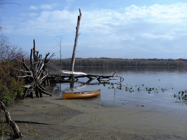
Nov 5, 2016 - HUDSON RIVER from Stockport Landing, started ~2 hours before low tide. Partly sunny, temp rising through the 50s, little wind. On a mission. Short paddle on Stockport Creek then S on the HR. Soon into East Flats, the bay was already fairly shallow, it's deeper along the N shore. N into a creek (L of a duck blind) to where my GPS had gone overboard 3 days ago. After a couple of sweeps I spotted it in ~15" of water & retrieved it. Back to the HR & stopped at a sandy beach for lunch at low tide. Examined the GPS, put it back together & it worked! after being submerged for 3 days! Wind picked up from the NW so headed out. Mission accomplished. Bald eagles, mergansers, gulls. 3.2 hours. Nov 2, 2016 - HUDSON RIVER downstream from Coxsackie. Started ~1.5 hours before low tide. Down W shore (light development) past 4 Mile Point to West Flats. Was able to find one deep channel into the marsh at low tide. Crossed over to Priming Hook & back on E shore (m...