Posts

Showing posts with the label Lake Champlain

LAKE CHAMPLAIN paddling
Image
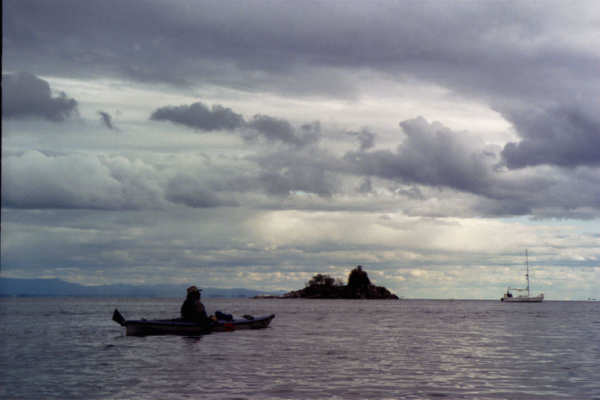
  Aug 9 & 10, 2009 - LAKE CHAMPLAIN.  Checked in to Ausable Point State Campsite & got the last on-water site at the mouth of the Ausable River.  20 knot winds from SE produced surf at the campsite.  From the Dead Creek parking area just outside the entrance booth paddled out onto the lake (N facing & out of full wind) & up the Little Ausable River for over a mile until downed tree.  Back & then carried across road to Dead Creek, a great spot for poking around in thru lily-pads & grasses enjoying the plants, wildlife & distant Adirondack mountain views; ospreys & nest; tons of wood ducks; swamp maples turning red.  Back at our campsite we were entertained by 2 guys in an aluminum canoe coming out of the river into the lake waves.  They got around the 1st point into the waves ok, turning to go downwind looked good & it looked like they were surfing.  For some reason they turned sideways to the waves & over th...

Hiking & Paddling: North Country Fall Foliage Adventures 2021

Image
  In most years, you can find peak fall foliage colors in the higher elevations of the Adirondack Park around the end of September and in early October. By Columbus Day weekend, the bright red and orange leaves of the red and sugar maple trees will likely have dropped to the ground, but the yellows of the birches and the golds of the beeches may still be evident.  In the High Peaks, one should not be surprised to see snow-capped mountains in mid-October – the combination of fall colors topped with white is a sight to be seen.  A number of years ago, a group of us paddled Follensby Clear Pond on Columbus Day weekend in a windblown snow shower - we camped on Polliwog Pond and awoke to 1" of snow on the ground. After the first week in October, you may still find dazzling colors at lower elevations and in southern areas. Here are some destinations that you may want to visit this fall that should be of interest to both hikers and paddlers. Jenkins Mountain The Visi...

LAKE CHAMPLAIN, SPLIT ROCK WILD FOREST hiking

Image
On August 30, 2022, the towns of Westport and Essex experienced a microburst that caused a tremendous amount of storm damage, including significant blowdown in the Split Rock Mountain Wild Forest. Many trails are completely impassable at this time. DEC staff and Forest Rangers will work to clear blowdown from trails. Oct 10, 2020 - SPLIT ROCK MOUNTAIN loop, from Lewis Clearing Bay Trailhead.  Counterclockwise this time.  There is a good lookout to the W before Ore Bed.  Spur to Ore Bed Overlook for great views to VT, Lake Champlain & High Peaks.  Could not find South Rocks Overlook - don't believe a marked trail exists.  Essex Overlook has limited views to Burlington - saw 2 Essex Ferries going in opposite directions.  Good fall foliage colors but a lot of leaves down already.  Lewis Clearing Bay Trail to unmarked Snake Den Harbor Trail - saw the eagles' nest but no eagles, just turkey vultures flying by - several viewpoints along this spur trail....

JABE POND, LAKE GEORGE ROGERS ROCK, SOUTH BAY LAKE CHAMPLAIN paddling.

Image
June 9, 2014 - JABE POND in Hague.  Mile drive on a dirt road, bumpy on a steep hill.  100-yard carry to the pond.  Just a mile & a half from Lake George but very different, 1,000' higher in elevation.  Less than 1 mile long but 3 miles of irregular shoreline & some piney islands to explore, good wilderness feel.  Lake George Wild Forest.  Osprey, loons, polliwogs in sandy shallows.  Saw a few blackflies but they did not seem too interested in my blood.  4+ hours (half the time relaxing at a campsite).     June 9 - LAKE GEORGE from Rogers Rock State Campground.  Stopped at the boat inspection station at the campground & was told that canoes & kayaks don't have to be inspected - it's just for trailered boats.  Windy early but calmed down.  Clear emerald water.  Cliffs to the N of the campground.  Passed diminutive Juniper Island to view Rogers Slide.  Anthony's Nose across the lake & ...

SOUTH BAY LAKE CHAMPLAIN & POULTNEY RIVER paddling, hiking

Image
June 22, 2022 - Put in from the state boat launch & headed S into SOUTH B AY staying close to the NW shore which has light development, incl. some rundown buildings & a farm, for a couple of miles - the view S is quite nice with The Saddles (within The Saddles State Forest) & The Diameter (I love that name) bordering the lake.  The Adirondack Blue Line runs down the center of the bay.  The water was a murky pale green, possibly due to the clay soil underneath.  Below The Diameter, talus reached down to the water, so we crossed to the opposite shore to stop for lunch - the shoreline consisted of boot-sucking mud thanks to the clay content but we were able to successfully exit the kayaks with some moderate stress.  There was a variety of lovely flowers on shore.  After lunch, we headed further SW into South Bay Creek which winds gently below rocky cliffs with silver maples lining the varied shores & bullhead lilies in the water - this is the best...