Posts

Showing posts with the label Lake George

FRENCH MOUNTAIN hike

Image
  July 22, 2024 - The trailhead is now gated! July 5, 2024 - FRENCH MOUNTAIN hike. LGLC Hike-a-Thon at the McPhillips Preserve. The trail goes along old logging roads, sometimes overgrown. Reaching 1360' el, we took a L & dropped down to the rocky lookout where there is a view to the southern end of the lake & LG village. Also in view are West, Darling, Potash, Hadley, Black Spruce, & Prospect Mountains. Temp 75-80F, mostly cloudy, humid. Fun tho. No issues with bad bugs. A few ripe blueberries at the lookout, black raspberries at the trailhead. Wild turkeys near the parking area. 2.4 miles, 928' el gain, 2.8 hours (1.6 hours moving time). Still no sign of any work being done about marking trails. Lower slopes are in the town of Lake George, higher elevations in Queensbury. Note from June/July 2024: the driveway for the below FRENCH MTN hike is chained off with a no trespassing sign: Nov 15, 2023 - FRENCH MOUNTAIN RANGE hike, from Bloody Pond Rd. I call it a range ...
SUCKER BROOK PRESERVE hike, northeast of Lake George

Image
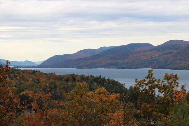
  Oct 24, 2023 - SUCKER BROOK PRESERVE, on the NE shore of Lake George, formerly known as Gull Bay and Last Great Shoreline Preserves, LGLC . Started from the Sagamore Rd parking area. Map at the kiosk (I had also downloaded it to my phone earlier). Blue trail 0.4 miles to the first lookout of the day, & a fine one it was looking S on Lake George with the Tongue Mtn Range across the other side. Orange trail with views of wetlands. Red spur crosses Sucker Brook (which flows S to N thru the preserve) & climbs to a ledge with a view overlooking wetlands & mountains beyond. Yellow trail (shown as green on the map) to yellow trail N (part old woods road, part rugged single-track with wood steps). R on blue, R on red to a small view to VT, lunch. Down to blue, & down, sometimes steeply to the lake - nice views from the dock, limited view from the bench at the lookout. Back up to yellow & S to start. Elevations ranged from 320' to 630'. Left some trails for another...

BUCK MOUNTAIN hike, Lake George NY

Image
  Aug 2, 2023 (Wed) - BUCK MOUNTAIN hike from Pilot Knob. 15 cars in the parking area at 9:30 am, 20 when I finished (I have been here when there were 100 cars - a reason to do this hike midweek). Temp rising through the 50s & 60s, low humidity. The route starts wide & flat but gets steeper the further you go. The first couple of miles look like old woods roads, sometimes smooth, sometimes rough & rocky. At ~3 miles there is an open area with blueberries and good views of Crossett Pond (private; I had become curious about that area when camped at Inman Pond some time ago) & the southern end of Lake George. Good views W & N from the summit area (I could easily pick out Marcy, Haystack, Basin, Saddleback, & Gothics in the distance), a bit more civilization (like Bolton Landing) in view than I would like - had to bushwhack a little to get a view E to the Greens. More blueberry picking - they were mostly very small. A few families with kids on the trail. 6.8 mil...

SHELVING ROCK MOUNTAIN & SHELVING ROCK FALLS hiking

Image
  Dec 9, 2021 - SHELVING ROCK MOUNTAIN & FALLS hike. Shelving Rock Road is fairly steep & my driver did not like the way it looked so we parked at the Hogtown trailhead (1,200' el) for Buck Mtn. & walked down the road. Some nice brook views along the way, especially at Campsite #12. Took a R at parking area #2 (500') on Big Bridges Trail next to Shelving Rock Brook for 0.9 miles, then L on Shortway Trail. After ~1 mile started climbing moderately up the mountain, lot of switchbacks keeps it from getting very steep. A little before the summit (1,130') not much in the way of views from there) took a R on a path for ~100 yards dropping down to a ledge with very nice views over Lake George. Headed back down & took the short 0.2-mile way back to the road, 1.5 miles from the lookout. 0.4-mile trail to the very scenic falls, then lime paint blazes to below the falls for the best view. Up & up the road back to the car. The trails in this area are on old c...