SARATOGA area hiking

Aug 28 - GREENTREE LAKE. Nice & peaceful.

Aug 25 - Wanted to continue scouting out the Southern Palmertown Range with a visit to LINCOLN MOUNTAIN STATE FOREST https://www.dec.ny.gov/lands/107159.html . From Locust Grove Rd, took a R on Greene Rd & in 0.1 miles took a L on dirt road with my mtb. Soon saw state land signs on the R. Went somewhat further until posted signs on the R. Ditched the bike & bushwhacked NE thru open woods with little understory staying to the R of the posted signs & yellow paint blazes. Reached a swampy area, the headwaters of Stony Brook, & soon turned back. Biked on pavement over to Cohen Rd which goes past a few houses then turns to dirt/rock into the SF. Spent some time at the pond, then out. Over to Lincoln Mtn Rd & Clothier Rd to MOREAU LAKE SP & took a walk to LAKE BONITA for lunch - mellow.


Aug 19 - GREENTREE LAKE hike, from Greene Rd, Greenfield Center, a few miles N of Saratoga. This preserve is owned by the Open Space Institute, info: https://www.openspaceinstitute.org/…/osi-protects-saratoga-… . Entered just E of 339 Greene Rd. The trail soon crosses N branch of the Snook Kill. Soon after I took a L on a good woods road & soon could see Greentree Lake thru the trees on the R. The "lake" is more pond than lake, very marshy at its W end & the more open E half has some Bullhead Lilies and lots of water shield. Kept on following woods roads, turning R at most intersections. Light mosquito activity; very quiet & peaceful. No trail markers - not for the directionally challenged. Elevation 700-800'. ~4 miles RT. Expecting the Southern Palmertown Trail to pass thru here on its way from Daniels Rd SF to Moreau Lake SP.


Aug 17 - ROWLAND HOLLOW CREEK PRESERVE.

Aug 16 - LAKE LONELY TRAIL. Rode over on my mountain bike & biked the half-mile south trail to the observation platform. Some wet & muddy sections. A few kayakers, and slow motorboats & 2 SUPpers. The trail gets very little use & is very overgrown. Info & map.


Aug 9 - DANIELS RD SF mountain biking. Borrowed an old mtb, no shocks. Carriage Trail west (a bit rough, some trees down) to the SF, R on Main. Break at "the swamp" on Here to There, saw green heron. Main, R on Carriage Trail east (nice).

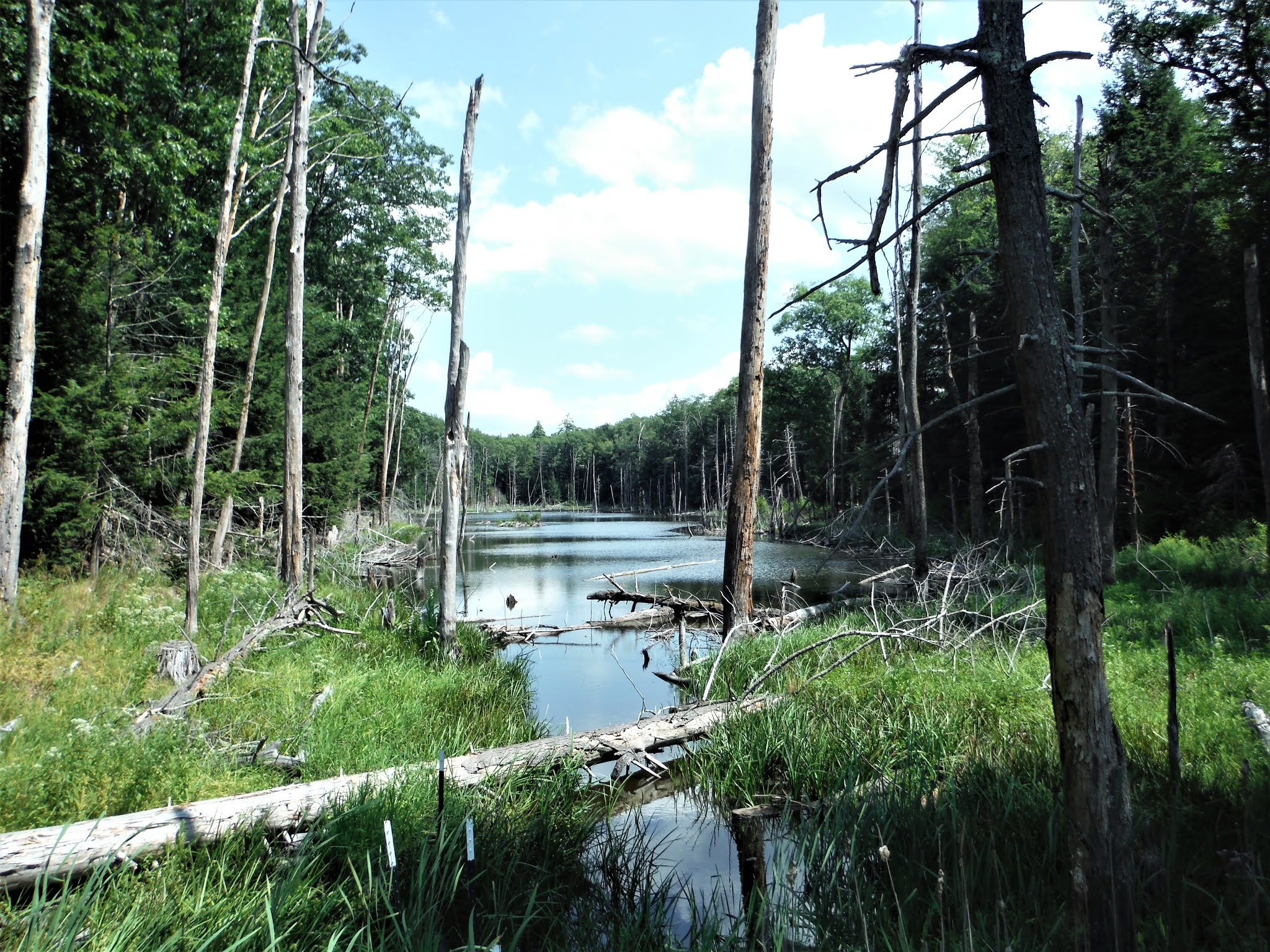


Aug 3 - DANIELS RD SF. Main > The Rookery incl. Dam Peninsula > Ridgeline (saw deer, high & dry, more hemlocks) > Main > Carriage east.


July 29 - DANIELS RD SF. Main Trail > Here to There > Main > Twizzler > Main > The Rookery (but not Dam Peninsula) & back. The red efts are growing up, much less mosquitoes.


DANIELS ROAD SF from end of Clinton. Great mushrooming - took home Chanterelle & Oysters. Saw 5 hikers, 3 bikers. 8 miles, 5 hours. 15.8 miles of trails in thw forest. 


SARATOGA SPA STATE PARK. Orenda Spring water falls over rock down to Geyser Brook.

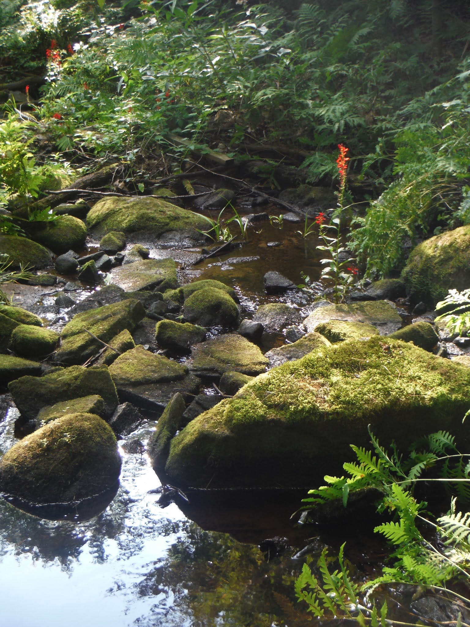
July 15, 2020 - DEVIL'S DEN, Daniels Rd SF. Red trail, then whack up in the canyon over mossy boulders for a closer look. Lots of red efts, mosquitoes. Saw 1 biker, 1 dog walker. Early start, done before noon. 8 miles,4.3 hours.


Monday, July 13, 2020 - DANIELS ROAD STATE FOREST from the newer, eastern parking area. Still needed to check out the Pilgrim & Sybil Trails to finish up all the state-marked trails in the SF. Pilgrim (blue) not-too interesting other than the W part goes past an old stone wall. Sybil (yellow markers) is typical for this area with twists & turns & ups & downs but does not pass any wetlands. Continued on the red Main Trail & took a R on The Rookery & straight on Dam(n) Peninsula to a nice spot overlooking a brook (w/bullhead lilies) & wet meadow, spooked a deer. White pines, hemlocks & red maples here - pine needles smelled so sweet! Spent 3.5 hours relaxing & reading, songbirds & frogs, chickadees & a woodpecker came so close I forget to identify it but could have been a red-bellied; again, not bothered by biting bugs. Finished the loop passing The Point - took 1.3 hours to get back to parking area. Mosquitoes & a few deer flies while hiking; red efts, mourning dove, thrush, chipmunks. Found my first bolete of the year & took a small sample to try (maybe I'll die), indian pipe in the woods. 6.8 hours. Map.


WOODS HOLLOW NATURE PRESERVE. Rowland St, Town of Milton (Ballston Spa). An assortment of pine-needled trails, some single-track, some super-wide. Small pond.


Fri, June 26, 2020 - BEE TRAIL Started at the junction of Daniels Rd & Clinton St & headed up the eastern Carriage Trail, easy walking on an old woods road on lands owned by Skidmore College. After ~1 mile, enter Daniels Rd SF & L on Main Trail (red) & past the beaver pond. R after the pond on Bee Trail, marked with SMBA markers because it leaves the SF & enters more Skidmore lands. Dead biker seen at House Rock, thru trees view of the swamp.


Palmertown Conservation Area MAP shows Skidmore College lands.
Thu. June 25, 2020 - DANIELS ROAD SF - Goals for today: Ridgeline & Here to There trails. From the newer parking area (the unmarked half-mile access road is just E of Shadow Woods Way & soon passes an old gas pump).


June 18, 2020 - MOREAU OVERLOOK hike. Moreau Lake State Park. 40 mins. to go up, very steep, gain ~800'; 30 mins. down. View over Moreau Lake to the E across the Hudson Valley to the Greens. Too hot with temp in the mid-80s, saw a couple of mosquitoes but none bit. Can hear Northway traffic. 2 miles.


Tue June 16, 2020 - DANIELS RD SF hike, from junction of Clinton St & Daniels Rd. Up a gravel old road into easement, a sharp L then R on eastern Carriage Trail, easy walking on an old woods road. L on red Main Trail, R on The Rookery, a nice single-track with views to the big meadow.


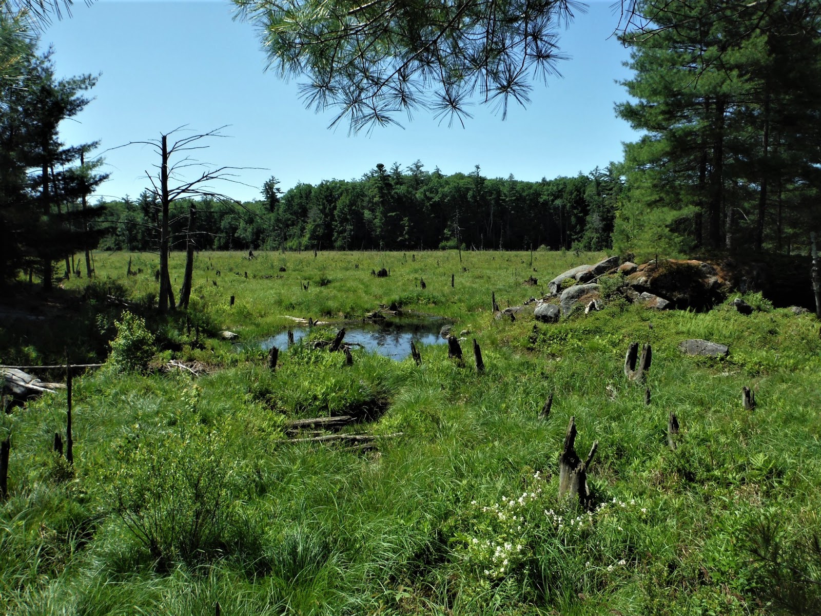


Sat June 13, 2020 - DANIELS ROAD SF hike, from the newer parking area (on Daniels Rd there is a pole for a sign but no sign at the beginning of the half-mile gravel road). Southern Palmertown Range, elevations 450'-700'. N on the red trail, soon passing a beaver pond. L on Putnam Brook Trail which goes to a large meadow & the brook, saw some mica in the trail. Looped back to red trail & N to loops on Devils Den (E side of the rocky canyon, needs more exploring) & Upper Canyon (over much smooth bedrock & past ledges, trees too high to get any distant views). Lots of blueberry, some green berries. Returned 3.3 miles on the red Main Trail. Lots of ups & downs, rocks & roots, no mud. Mosquitoes, chipmunks, heard red-bellied woodpeckers. Saw 15 bikers (all male) & 6 hikers (3 female). ~9 miles, 6.1 hours. A trail is planned that links Daniels Rd & Moreau Lake SP via Lincoln Mtn SF: more info.


Sunday, June 7, 2020 - DANIELS ROAD STATE FOREST hike, in Town of Greenfield, N of Skidmore College. Needed some exercise to start losing some of that extra weight that has accumulated over the last 2 months. Interestingly, this was part of the former Finch-Pruyn lands deal that also got us the Boreas Ponds tract. I had low expectations since I could not find much online about the area except on some mountain bike sites & I was not going to write it up, but I found it very interesting... Started at junction of Clinton St & Daniels Rd, gravel path past gate then L & L again on old woods roads. Hit state land after ~1 mile & picked up the red trail at junction with Twizzler. Headed N then R on The Rookery, soon arrived at The Point - good bug-free breezy spot with meadow view. Back to red trail up to Lucy's Point Trail then R with more meadow views. S on red trail to new parking area then 20 min. walk on gravel access road then W on Daniels Rd for a bit to my start - now that I know, next time I will just start at the new parking area. Rolling, sometimes rocky terrain with lots of twists & turns. Mixed woods with white pine, hemlock & variety of hardwoods. Surprised that it felt wild, peaceful & well away from civilization. Saw 11 bikers & 2 hikers. Trails good for intermediate to expert bikers, not much easy stuff - personally, I won't be becoming a mountain biker, I see more when I walk... No mud, not much rain recently. The meadows (shown as blue ponds on the map) look like they may have been beaver ponds many years ago. Note to xc skiing buds - put this on the to-ski list. Mosquitoes on the trails, none at The Point lunch-stop, some black flies in the gravel parking lot.. 6 hours, 8+ miles. Would like to get back soon to explore more - Lookout on The Rookery, Putnam Brook, Devils Den & Upper Canyon. Map Some background & bikers view: https://www.adksports.com/2016-06-mtn-biking


June 27, 2020 - ROWLAND HOLLOW CREEK PRESERVE. Birdsongs. Ist wild strawberry of the season tasted good.


June 5, 2020 - ROWLAND HOLLOW CREEK PRESERVE walk. Single-track trails, 2 loops & blue spur trail to the clearwater creek, short but very nice piney woods. No bad bugs. Canada mayflowers. More info.


BOG MEADOW - flat old railroad route, some bumpy rr ties. Interesting nature.
June 3, 2020 - tiny forget-me-nots. More info


LAKE LONELY NATURE TRAIL - hard to make out the trail at first but soon becomes obvious, flat, view of lake from platform at the end. More info
June 3, 2020 - pink ?, yellow flag, forget-me-nots, Mayapples, mosquitoes, painted turtle, woodchuck.


SKIDMORE NORTH WOODS - a few miles rolling loops, mostly hardwoods, a few pines on orange trail. More info
June 4, 2020 - very little flowering, mosquitoes (15% picaridin worked well).


Comments
Post a Comment