NOOSA'S BLUFF & BERRY POND & PATENT LINE MOUNTAIN hike & ski


Oct 18, 2023 - BERRY POND & PATENT LINE MOUNTAIN hike. PLM has been on my radar for a while even tho I did not expect it to have any views - it is named on maps despite its unimpressive 1929' elevation - there are higher peaks nearby that are not named. The route to BP was mostly on old woods roads & snomo trails, some marked trail. From S of BP I headed past a gate going W on Secondary snomo trail 42C & down to Berry Pond Brook. Started bushwhacking very steeply from just past the brook heading N then NW - got some small views. Turned W, much easier uphill. Found an old logging road & happily followed that to the summit which has some rock but is wooded. However, little S of the summit was some open rock with views SE & SW. Some artifacts, like grills & a pot, were evidence that I was not the first one up here. Got some pics in & it started to rain lightly - the sun made an attempt at breaking thru. Decided to follow the old logging road down - it goes E, soon following a brook that flows into Berry Pond Brook, some blowdown, then turns SW, eventually crossing BPB, & meets the snomo trail just E of where I had left it! Returned the same way with a brief break to soak in the colors at BP. The light rain stopped shortly thereafter. 10.2 miles, 1770' el gain, 6.6 hours. Brought home some honey mushrooms. Nice seat at the summit:


Sep 14, 2023 - Low humidity (for a change) & temp rising thru the 50s & 60s - nice hiking weather. Did a combination of old woods roads, bushwhacking, & marked trails. Hit the narrows lookout, Noosa's Bluff, West Brook, & more. Brought home some lobster mushrooms. 5.4 hours.
.JPG)
.JPG)
.JPG)
.JPG)
.JPG)
.JPG)
Aug 28, 2023 - BERRY POND & NOOSA'S BLUFF hike. Part marked trail & secret trail to the pond. Clockwise around the pond. Triple beaver dams at the outlet flooded the trail - I crossed on the middle dam. Up to the lookouts - Noosa's Bluff (not the official name, Noosa was a dog, there used to be a story about it at the kiosk by the parking area but it is no longer there) looks S to Darling Mtn & Butler Pond. The eastern lookout has a small view of Lake George (incl. Long Island & Black Mtn). Both views should be better when the leaves are off the trees. Back on the blue trail (not as nice as my secret trail). Very light mosquito activity, and some annoying gnats. Good shrooming - I brought home a chanterelle, a horn of plenty, & a colorful bolete (looks like boletus subvelutipes - my book says "edible, but not recommended as some red-pored boletes are poisonous" so I'll just enjoy looking at it). Saw 1 other hiker. Junctions near the pond are not well marked. 8.2 miles, 1588' el gain, 5 hours.
The view of LG is better from the top of the sledding hill at the Rec Ctr:
.JPG)
.JPG)
.JPG)
.JPG)
.JPG)
.JPG)
.JPG)
.JPG)
.JPG)
.JPG)
.JPG)
.JPG)
.JPG)
Nov 8, 2022 - Figure 8 loop hike to BERRY POND on a combination of marked hiking trails, an old logging road, & snowmobile trail. A cold morning with gusty N winds, so I decided to start at noon - the wind died down, temp in the upper 40s, sunny. Looped around the pond counterclockwise, stopped for a brake on the sunny N shore near a beaver lodge, drank a beer (Sixpoint Anti-Resin, a hazy DIPA). The highlight of the hike: on the way out, I spotted an ermine in winter coat (all white with black on the tip of its tail) which made a wide circle around me so I was able to watch it for about a minute - it kept moving so I could not get a good picture of it tho. 6.9 miles, over 1,000' gross elevation gain, 3.9 hours.
.JPG)
.JPG)
.JPG)
.JPG)
.JPG)
.JPG)
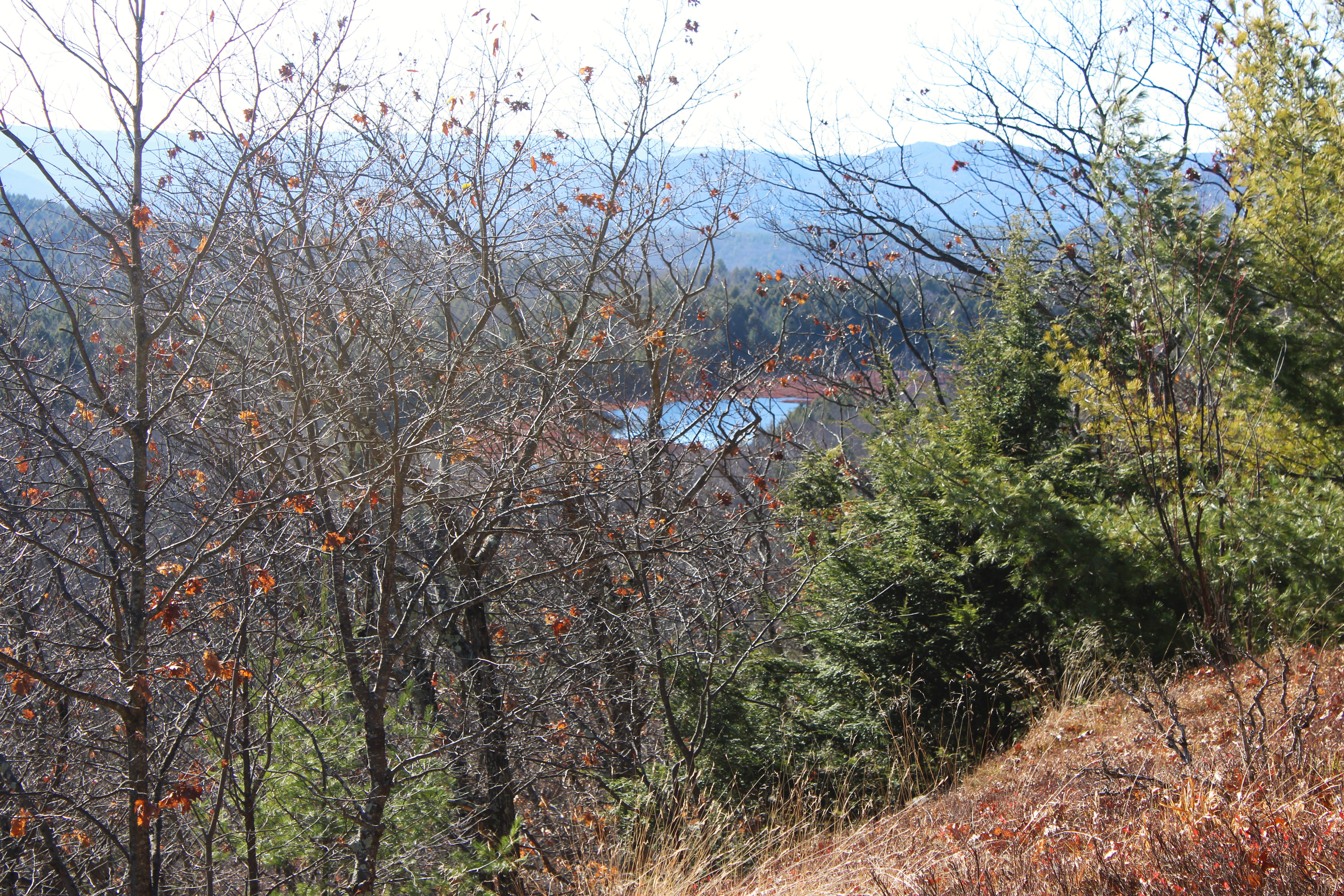
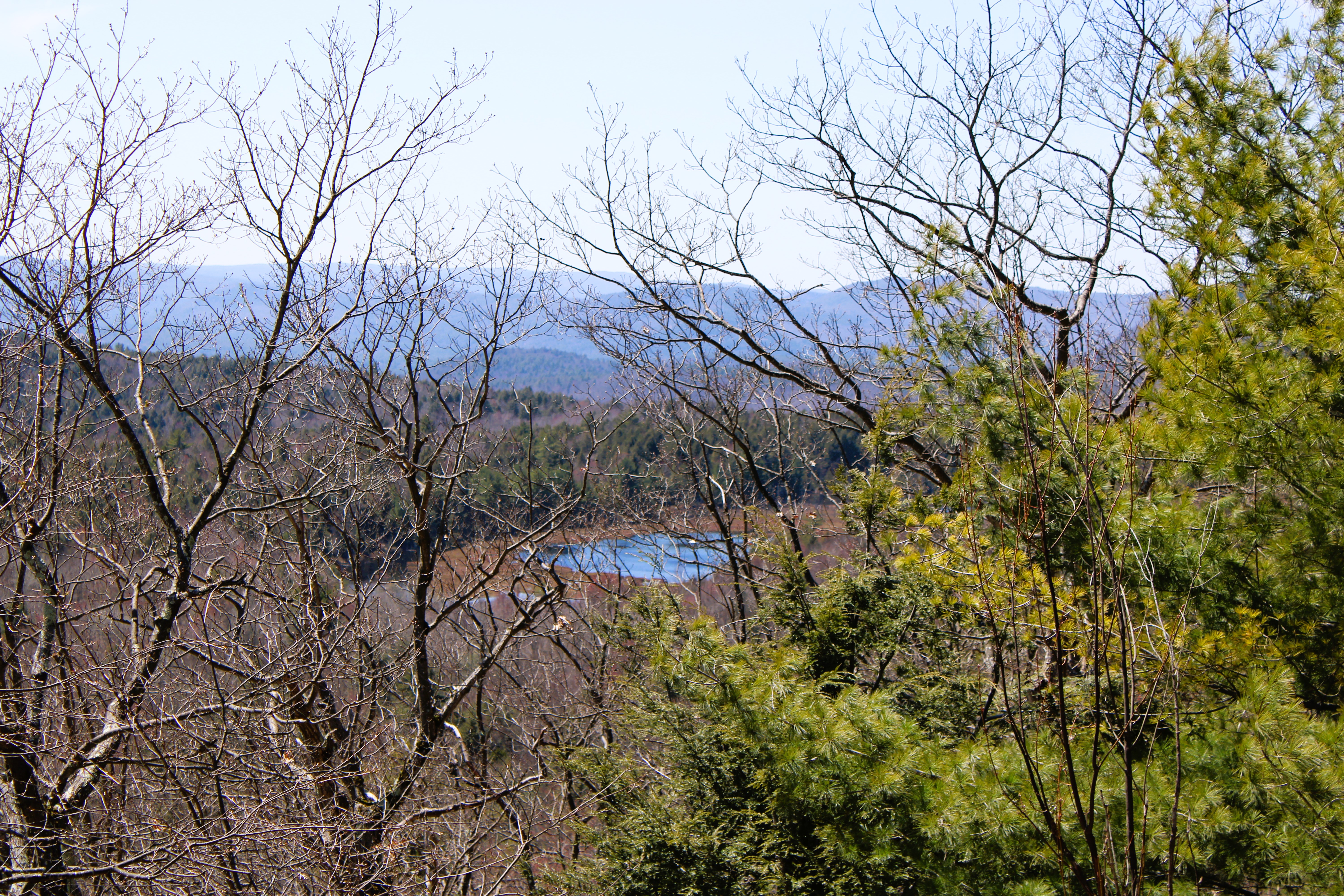
Oct 19, 2022 - NOOSA'S BLUFF hike, from the rec ctr - the story of Noosa used to be on the kiosk but sadly is no longer there. Took an unmarked old logging road that climbs from the junction of Magua's Revenge & Triohero trails - this is a much nicer (smoother) trail than the blue trail (rocky, washed out, uneven). After 1 hour, I took a L on a good dirt road & soon hit the blue trail - straight leads to Berry Pond & a L heads up to the bluff - I took the latter. Views from the bluff are to the S - despite a lot of clouds I could see the southern Greens & possibly Mt Greylock. 100 yards further along the trail, there is a view to Lake George & Black, Buck, & Pilot Knob Mtns. Back the same way with some detours to West Brook. Foliage a bit past peak. Temp in the low 40s, breezy. 5 miles, 1,000' el gain, 3.5 hours.
.JPG)
.JPG)
.JPG)
.JPG)
.JPG)
.JPG)
April 25, 2022 - Initially planned to look for the elusive Viper's Grotto loop at the LGRC but could not resist further exploration. From the junction of Triohero & Magua's Revenge trails I followed an old woods road uphill to the NW for 1.2 miles, paralleled West Brook which was heard but not seen. Reached a good dirt road & turned L (a R turn soon leads to a gate & private property), & soon reached the BERRY POND trail. Down toward the pond & R on the snomo trail. Walked around the pond clockwise. Lots of beaver sign & birds incl. ducks, swallows, chickadees, sparrows. Pleasant break by the boggy pond. Down on the orange trail (also snomo), then L on rough & rocky blue trail back down to the LGRC. Temp rising thru the 60s. 6.2 miles, 1,178' el gain, 4.2 hours.
.JPG)
.JPG)
.JPG)
.JPG)
.JPG)
.JPG)
Sun July 11, 2021 - BERRY POND. Bugs (maybe some blackflies) flying around me half the time - none when I took a break on the S shore. Boggy pond, lots of fragrant white water lilies, including pink ones. Very peaceful.


Sat Nov 7, 2020 - NOOSA's BLUFF hike from LG Sand & Gravel. Up the snowmobile trail to the 3-way junction before Berry Pond, straight on Blue trail. When blue trail went R, I went straight to see where this woods road would lead me to - went up for a bit then flattened out for a while & came to an open gate with posted signs. Went back to blue trail & up to the Bluff. Good hazy views today could see Berry Pond below & Potash Mtn beyond. A bit further to Lake George view then down steeply on slippery leaves. Saw no one even tho there was 1 car parked before the closed gate at the start, & 3 pickups beyond the gate (assumed they were hunting). 2.7 hours.


Sat Sep 19, 2020 - same loops as before, Saw a red fox in the trail on the way up. With leaves on the trees I could not see Berry Pond from Noosa's Bluff. To the S, could see Butler Pond, maybe a frankenpine on Darling Mtn, the Helderbergs in the distance.Great hiking weather with temp in the 50s & sunny. Saw 5 other people. A hint of fall color. 6.5 miles, 3.6 hours.


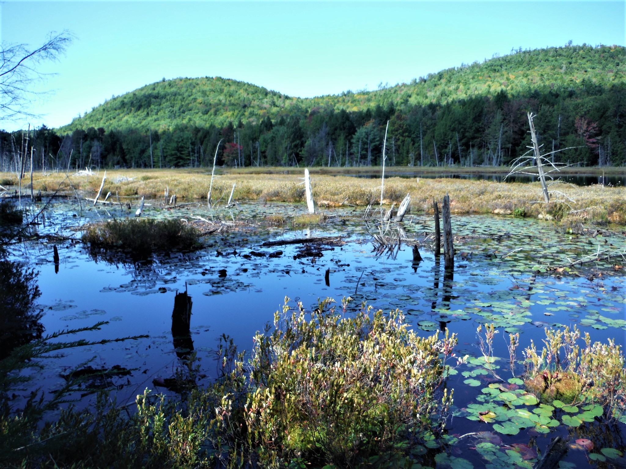

March 5, 2017 - From Lake George Recreation Center (720'). Followed blue markers thru the Gage Brook xc ski trail system. From 204th Way, took a L & started climbing on a rough rocky trail. Dropped a bit then continued climbing to the 2 lookouts - the 1st, at 1,620', looks over a large clearing NE to Lake George & the Green Mtns can be seen in the distance; 2nd, Noosa's Bluff at 1,640', looks S with Berry Pond seen to the SW, thought we could see Mt Greylock. Easy downhill to loop around Berry Pond (orange markers, 1,380') - no trouble crossing the outlet where there are 2 beaver dams. Down on snowmobile trail to pick up the blue trail again. Walked down next to scenic Gage Brook which had many icy cascades. Some hard snow, ice & bare patches, no mud with temp in the 20s - MicroSpikes worked great. 6.6 miles, 4.6 hours. Map & more.


Comments
Post a Comment