JENKINS MOUNTAIN, BLACK & LONG PONDS hike & ski
Feb 28, 2023 – BLACK & LONG PONDS, JENKINS MOUNTAIN TRAIL ski, from St Regis Mtn trailhead (Black Pond trailhead not plowed) on Keese Mill Rd. Black Pond east side trail – lots of ups & downs – came close to groomed trail of the VIC – some icy base noted. Lean-to. Saw a deer shoot across the pond. Pond-ski to N end & picked up the trail to the W side of Long Pond. Half-mile to Jenkins Mtn Trail & went L. Groomed for a bit. Ups & downs over eskers & hardwoods (deeper powder). Gave up when the trail got steeper. Path to top of esker that parallels the ponds – L to the summit of the esker – decent views of Jenkins & Long Pond – saw 3 yellow paint blazes & there were some old snowshoe tracks. S on esker & woke up a deer. Ups & downs for a while then a short traverse down to the S end of Long Pond. Checked out the fish barrier dam then skied down the W side of Black Pond then across the pond, into a good headwind, to the Black Pond lean-to for a nice break – watched some “wilderness tv”. Saw 2 deer as I left. Back to Keese Mill Rd. Had some time, so skied the unplowed road to the Topridge gate & checked out where the canoe carry goes. Mostly very good skiing around the ponds where trees were mostly softwoods, excellent skiing with up to 15" of powder over a good base on the JM Trail (mostly hardwoods) & on the esker . 5 hours.
Temp in upper 70s. Drove over in a Miata convertible with the top down. Took a swim in Lake Clear - the water was cool but just bearable. Lots of loons on the lake.
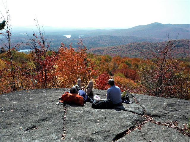
Aug 11, 2003 - JENKINS MT. hike. Helped friends with shuttle before their trip in the St. Regis Canoe Area. Little Clear Pond canoeing - heard loons & saw some fly by. One of the busiest entries to the Canoe Area & there was only 1 other car here on a Monday morning! Bell Northstar, a 16'6" tandem composite canoe paddled solo - quick to accelerate, very good secondary stability (easier to dip the gunwale under water than in the composite Northwind, tho), fun to play with some freestyle moves, easier to solo than the 17'6" Northwind. Over to Hoel Pond where there were a few vehicles parked. Drove over to the VIC in Paul Smiths for start of the hike. First couple of miles are over a dirt road thru a demonstration forest. After an outhouse & a beaver pond with views to the cliffs on Jenkins, the trail becomes a more interesting narrow path & for a while follows the top of an esker. Not much elevation is gained til the last mile when the trail u-turns up the mountain. Past forest fires have left tall thin maples with an understory of raspberries & ferns. Was able to stay reasonably dry thru a short rain shower but the wet vegetation on the narrow trail the rest of the way soaked me thru. Equinox Extreme Supplex nylon zip pants dried quickly; OR Vaporizer shirt took longer to dry but I find it more breathable & confortable on the skin than nylon; both dry faster than cotton. Lucky to have some sun while on top. Impressive views (hazy today) are from a rocky ledge with many blueberries. To the W could see Follensby Junior Pond & Azure Mt.; to the S, St.Regis Mt. dominates with Upper Saranac Lake in the distance; to the E & SE are the High Peaks. 780' climb, 8.2 miles, 5 hours. An alternate route is to paddle Black Pond, carry 0.3 mile to Long Pond from which a path connects to above trail. Stopped at nearby Osgood Pond for swimming - sandy bottom at the boat access on White Pine Rd.
Visit us on Facebook

.JPG)
.JPG)
.JPG)
.JPG)
.JPG)
.JPG)
.JPG)
.JPG)
.JPG)


Comments
Post a Comment