CEDAR RIVER ELM ISLAND & McGINN MOUNTAIN XC skiing.


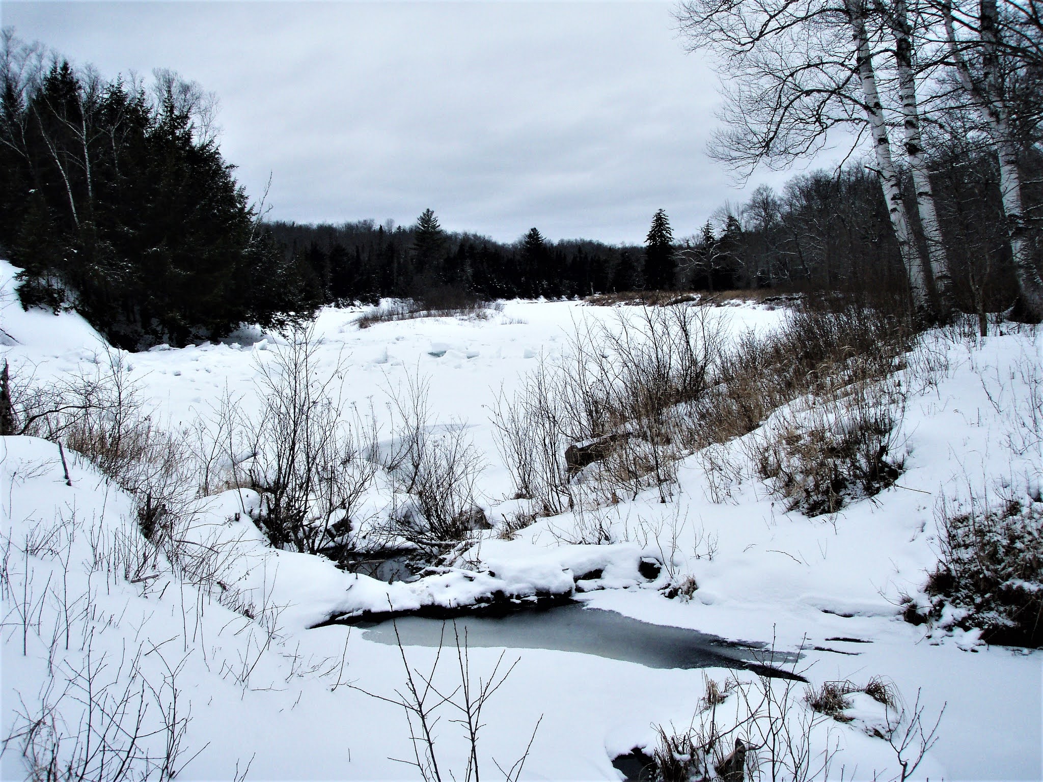


Mar 5, 2006 - McGINN MOUNTAIN, N of Indian Lake Village. Temp rising thru 20s getting close to freezing mark - warm in the sun. Good base with few inches of powder - very good skiing - sunny areas got a bit mushy & started to freeze up late in day as temps dropped. From the end of Benton Rd (next to old landfill) take snowmobile trail NW a third of a mile - from here a designated ski trail follows the scenic Cedar River downstream for over a mile to Pasley Falls, a rapid contained by rock walls. Trail then heads SE thru an old blowdown area with many balsams before reaching a 4 corners. R or S is snowmobile trail back to car, straight is snowmobile trail to Lake Adirondack, L or N is 2.5 mile red trail to Elm Island on the Cedar River. Taking the latter (a large downed tree blocks the start) generally uphill for a while we pass thru an almost pure stand of paper birch before dropping to a stream at 1.5 miles from 4 corners - xc ski trail markers are found on either side of trail (an old ski trail used to run along the river from Pasley Falls to here). We head off-trail to the SE staying to S of stream & cliffs on McGinn. Fairly smooth going with little blowdown. Put on climbing skins (the 2 skiers still with me did not & had to work harder) as things steepened. 3 others head above first set of cliffs, take off skis & hike up S side to summit arriving a few minutes before those of us who keep our skis on & take a longer, more moderate route. Round the E side of McGinn at 2,000' & see large gaudy paint blazes leading us W up a short steep stretch (side-stepped) before moderating a bit. The high point can be seen to the SW & we soon reach a ledge (having gained 600' from the Elm Island Trail) with great views to S & E - could pick out Gore Mt., Snowy Mt., The Hudson River Gorge, Indian Lake & lots more. A cloudless blue sky day offers very distant views. A bit to the W a clearing opens up views to the High Peaks to the N & Blue Mt. can be seen thru the trees to the W. Savor the summit. We drop down to the E side again ( I wish I had brought my plastic boots & possibly skis with cable bindings; leather boots got me thru but plastic boots would have offered better control & more fun) then head around N side of the mountain & bushwhack (in every sense of the word) W - not a great route & nowhere near as open as the route to the S. Come out on the Elm Island trail about a quarter mile N of where we had left it. Passed an unofficial sign on a tree which says "Elm Island" (can see the river from here) - actual Elm Island is a mile N of here. Back at 4 corners take snowmobile trail back to cars which offers a fast downhill ride (after climbing a long hill). Description of route can be found in Discover the Central Adirondacks (3rd Edition, 2002) - the Cedar River-Pasley Falls trail/snowmobile trail loop is accurately described & so is the trail to Elm Island (now with red trail markers & some maintenance) but ignore the bushwhack route to summit - the map in the book takes you to a nubble to the N which is 200' lower - actual summit is marked 2,216' or 681m. on most maps - the name McGinn Mtn. I have only seen on a map put out by the Indian Lake Chamber. The Dutton Mt. USGS map shows the old ski trail which used to go around the mountain but we saw no sign of it. Intermediate on marked trails; intermediate+ off-trail to summit if using skins or snowshoes; expert off-trail to summit skis only. 9+ miles, 7 hours. I'll be back!

Mar 28, 2004 - CEDAR RIVER & PASLEY FALLS skiing. 0-12" wet hardpack with some barespots - stream crossings a problem. From the old Indian Lake landfill, took a L on snowmobile trail & was soon at Cedar River, still mostly iced over. A R leads along a xc ski trail tp Pasley Falls. First stream crossing is bridged but 2nd was not so turned around to start. See fresh mooseprints crossing the trail. Took snowmobile/xc ski trail R about a mile to 4-way junction: straight leads to Elm Island & McGinn Mtn. on old unmaintained trail, R to Lake Adirondack & L to Pasley Falls. After passing a cedar swamp, one passes thru an area of blowdown where small beech & balsams are growing in - Snowy Mtn. can be seen thru the trees. After a half mile of small ups & downs, reached the falls which are more like a class 3 rapid between rock walls - a very pleasant spot to lay down the full-length ultralite Thermarest for a long break in the warm (50s)sun listening to the turbulent waters. Below the falls are more rapids & the river was mostly ice-free. The only map that has these trails right is found in McMartin's Discover the Central Adirondacks - the new ADK trail guide chooses to ignore these trails & other maps show old grown-over trails. Got done early so drove S & snow was noticeably deeper. Best snow in Speculator/Piseco area. Driving S on Rt.10, the W Br Sacandaga River was somewhat open but with a fair amount of ice still. SHAKER MTN WF - short ski up old road at end of Pinnacle Rd - same story, streams running, steeper south facing slopes have many barespots. Bushwhacked E for a while trying to stay on high land to avoid streams - skiing wasn't too bad where there was snow. Fischer Rebound skis did fine - thought leather boots were my weak link today, needed to be able to transfer more power to the skis in the heavy wet snow - plastic Garmont Excursions would have been a better choice.
Mar 27, 2003 - PASLEY FALLS, CEDAR RIVER xc ski. Start from end of Pelon Rd in Indian Lake Village at old landfill. Good skiing on snowmobile/ski trail - fair skiing on ski & backcountry trails. Average of 1' of heavy snow. Ski trail along river had some wet spots (water skiing, anyone?) - 1 stream was bridged, another was not & I turned around & went around from other direction to the falls after going part-way to Elm Island. Huge (up to 10'x20'x2') chunks of ice going thru the falls - spectacular scene on this warm sunny day. Karhu Dorado skis with leather boots.
Feb. 27, 2001 - Started out at the old Indian Lake village landfill (which I summited - nice view) following xc ski trail markers along the Cedar River - very scenic skiing next to the river which was still mostly iced up but definitely thawing. Animal tracks were abundant in the wet granular snow (depths ranged from minimal on snowmobile trails to a foot & a half in the woods) - the skiing conditions were not the best of the year but the warmth (got up to 55F) & views along the way were a treat - no gloves all day. Lunch break at the rapids (Pasley Falls) - the sound of the water was soothing as I contemplated what line I might run in a canoe. Pushed on toward Elm Island but stopped short due to blowdown & lack of time (did not make an early start), took a break & listened to the warm wind blow thru the birch forest. Terrain has enough ups & downs to make the skiing quite interesting. Area of blowdown en route allowed for views of Snowy & Blue Mtns., smell of the balsam firs added to the ambience. Tried out super sidecut Fischer Vision Mountain Crown nowax skis mounted with 75mm Super Telemark bindings (basically a heavy duty 3pin) - wouldn't be my first choice for a trip like this but might be fun in powder on steeper terrain. Friend used universal klister on touring skis which worked well. Had Maxiglide on my skis & experienced no sticking.


Comments
Post a Comment