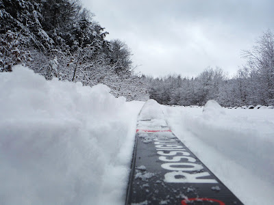
Note: When there is a lot of snow, the 5.5-mile Prospect Mtn Veterans Memorial Highway is open for snowmobiling so, if you want a quieter ski, pick a day when there are just a few inches of snow (6" is nice).
Check this site to see if open to snowmobiles.
Jan 27, 2025 - Skied the toll road to the summit of PROSPECT MOUNTAIN. 3" at 1000' el, 6" above 1500' el - very good skiing. Some spots were windblown but no bare spots. When there is a foot or more snow the road is opened to snowmobiles. Saw no-one. Temp in upper 20s to low 30s, mostly sunny, gusty winds at times. Not too windy on top, so hung around for a while admiring the views, including the High Peaks, Lake George, Green Mts. 5 hours.
Nov 29, 2024 - 1.5"-2" of frozen wet snow (faster skiing, skis sunk in just a tiny bit) at 1000' el, 8" of powder (slower skiing, skis sunk in 3") at 1400' el. Mostly sunny, temp in the low 30s. 2 hours.
April 5, 2024 - PROSPECT MOUNTAIN HIGHWAY & MORE ski. 6" & crunchy at 1000'. There were ski tracks to ~1200', then I was breaking trail. 8"-10" at 1400'. Went off onto an old woods road & bushwhack - much less crunchy in the woods. Dropped 400' on an old woods road - surprisingly good skiing. Climbed back up to the Hwy. As I was passing the red trail, I heard a not-too-distant sound - maybe snomos I thought? 6 power company trucks soon came barreling up the road (no plow)!!! Dropped down 300' on another old woods road - skiing was good down to ~700' el. Temp rising thru the 30s, mostly cloudy, some hazy sun early & late. 11.5 miles, 6.3 hours.
Ski day #45 for the season.
Feb 23, 2024 - Decent base topped with wet powder - good (slow downhill) to very good (in my tracks) skiing. Deer. 3.5 miles, 350' el gain/loss,1.5 hours.
Feb 18, 2024 - 4.3 miles, 531' el gain/loss, 1.8 hours.
Feb 16, 2024 - 2" of fresh powder on a good base. Closed to snomos. Hiked up to 1000', and skied up to 1800'. Very good skiing for the most part, got sticky in sunny part near the hiking trail. I got first human tracks, altho quite a few critters did get out ahead of me. 2.6 hours.
Feb 11, 2024 - After a few very warm days I wasn't expecting much. Hiked up the red trail to the road & was pleasantly surprised there was still good coverage - up to 6" of dense snow & the skiing was excellent with good glide & very turn-worthy on the hills.
Feb 1, 2024 - Back on the snomo trail (recently groomed, still closed to snomos but 2 did pass by). The groomed part gave me some uphill glide & was fast downhill. The ungroomed areas to the side still had 2-3" of heavy powder & a bit less fast on the downhill. Temp in the low to mid-30s & misty. 7.5 miles, ~850' net el gain/loss, 3.1 hours.
Jan 29, 2024 - 3" of new powder on 5-10" of base. Snomo trail closed - had the place to myself. 1000'-1630' section. 2.5 hours.
Jan 24, 2024 - Very good to excellent skiing on 2" fresh wet powder on groomed base. ~10 snowmobiles went by. Skied to 1440' el.
Dec 14, 2023 - Hiked up the red trail (<1" of snow) to the parkway. Just enough snow to ski on to past the Eagle's Eye then much better with 3-5" of powder with some icy base. Turned around at 1640' elevation. Temp approaching 32F. 4.7 miles of skiing, 600' el gain, 1.8 hours.
Dec 1, 2023 - PROSPECT MOUNTAIN hike & ski. Warm temps & rain expected so had to get in 1 more ski before conditions worsen. Hiked up the red trail <1 mile to the road & put on the skis. 1 lane had been plowed, good skiing on the rest of the road, a bit thin for a while, but got much better after the Eagle's Eye viewpoint. A tracked vehicle had gone up from here & skiing the tracks was very good. Had good uphill glide & I made decent time. The plowed lane ended at ~1600' el - seems like the plow gave up after hitting 6" of heavy wet snow. Made it to the top, there was a little less snow on S-facing areas but still enough to ski. High Peaks were hazy. Nice going down - slower in virgin snow, faster but controllable in tracks, Soon saw the tracked vehicle coming up. Got done before the rain came. Temp in the mid-40s so the snow was soft & not icy - spring conditions in early December! 8 miles, 1600' el gain, 3.5 hours. 6+ miles, 1000' el gain, 2.3 hours on skis.
Apr 7 - Contiguous snow on the road above the Eagle's Eye overlook. Into the woods at ~1400' el. Some on old woods road, mostly off-trail on up to a foot of dense snow - good to very good skiing. Too much water to cross Big Hollow Branch so explored both up & downstream. Temp did not go below freezing overnight & mid 40s while skiing.
Mar 20, 2023 - Carried the skis up the red hiking trail, spikes on my ski boots. Skied up the snomo road (a tracked vehicle & a few snomos went by) to that 1,450' el & headed off on the old woods road. 2 streams crossings had very good snow bridges. Picked up Big Hollow Rd & up to Big Hollow & the old reservoir, now just a beaver pond. Felt great to be out in cloudless blue skies. Chose to ski on the powerline - it's open slopes had received much sun & the snow surface was soft. More old woods road then down the snomo road. Skied off-trail S of the hiking trail - very steep - traversed a lot & did some side-stepping but made it down without falling. 1-2 feet of snow. Temp upper 30s to mid 40s. Good to excellent skiing. 7.5 miles, 1200' el gain/loss, 5 hours.
Mar 9 - Started out on the red trail but soon veered off-trail & zigzagged up, had decent grip as long as I did not go straight up - soft snow in sunny areas, crunchy in the shade. Uphill on the snomo superhighway - very good, softened by sun, fluffed up by the snomos. At ~1,450' el picked up an old woods road and took it to Big Hollow Branch - nice dense powder. Returned then continued down on old woods road high above BHB - nice snow down to ~1,250' then there was some crust but skiable with care. Back to the parkway. The snomo groomer had flattened the snow on the lower half of the road while I was above - fast & icy in the late afternoon shade but I took it all the way down then had to walk thru the village back to start. Temp in the mid to upper 30s. 10-15". 4.6 hours.
Mar 8 - Very good conditions today
Feb 14 - Carried the skis up the hiking trail. Skied the road 3.5 miles to the summit. The snow/ice was soft where the sun had shined, but still fairly icy in shady areas. A tracked UTV went by with 2 workers, otherwise saw no one on this beautiful warm (low 40s) day. Very clear sky - could see Mt Marcy, Algonquin, lots of the Green Mtns, & some of NH. 8" of snow near the summit. 9 miles, 5 hours.
Feb 12 - Warmer than average weather over the past week. The gate closed to snomos. Waited until afternoon & temp in the low 40s. The plan, to avoid doing much downhill in fast icy conditions, was to go up from near the start & hike back down the hiking trail. The sunny areas were not too bad but the sections that receive little sun were still icy. Not the best conditions for skiing but good day for beautiful views. 4-6" off to the sides in ungroomed areas. 4.7 miles of skiing, 700' el gain, 2+ hours, + some hiking.
Jan 21, 2023 - Hiked up the red trail to the toll road (1,000' el). Skied uphill to ~1,650'. Very good skiing on 2.5" of base topped with up to 1.5" of powder which had fallen overnight. Took a short side-trip into the woods but only about 2" there. The conditions were good enough that I decided to skip hiking down on the red trail & stay on the road - got in ~1,200' of downhill skiing. The snow was a bit thin by the time I got down to the toll booth but still quite skiable. Had to walk 0.8 miles thru the village to get back to the start. A Saturday but I saw no one. 3.9 hours total, 2.7 hours on skis.
Dec 27 - Breaking in new Fischer Transnordic 75 boots.
Dec 21 (Winter Solstice, altho winter did not officially arrive until after sunset today, so this was technically my last trip of Fall) - Forecast called for sunny skies, little wind, & temp rising thru the 20s + I knew that the toll road had been groomed but snowmobiles were not yet allowed. Carried the skis up the hiking trail (gain of 600' in 0.7 miles). Found the groomed area on the toll road had been widened to 15-20', 10" of snow to the side. Got to the summit around noon - ~15" there. Really good views of Lake George & the High Peaks (48 miles away). The run back down was very pleasant, not too fast. Saw 2 hikers, and I had the toll road all to myself. 8.8 miles, 1,650' el gain, 4.7 hours.
Up top:
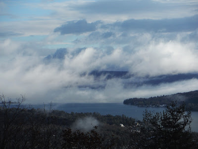
Can you see the lake?
Dec 17, 2022 - Woke up early, forecast for temp rising to the upper 30s - figured the new snow on the trees would be raining down, so it made sense to hit the road where that would not be an issue. 3" of heavy wet snow at the Rt.9 start. Both gates were open, and a snowmobile had been up but I don't think that the road was officially open to them (saw no one). 4" by the bridge over the Nway, 6" soon after, and kept getting deeper with elevation. Some downed trees partially blocked the parkway. A mouse/vole ran across in front of me. Skiing in the snomo track made things easier, much harder work whenever I was pushing thru virgin snow. 15" (felt a bit like soft styrofoam) by the time I got to The Narrows viewpoint but fog obscured the lake. Crossed the hiking trail - someone had post-holed thru! Turned around at the next viewpoint - could see the top of the French Mtn ridge, like an island above the fog. A bit faster going down, especially in my tracks - slower in virgin snow. 6.9 miles with some extra exploration, 787' gross el gain, 3 hours.
.JPG)
.JPG)
.JPG)
.JPG)
Dec 13 - Hiked up the red trail & skied the parkway up to 1,400' el & hit all 3 lookouts. Temp dropped into single digits early but was rising thru the 20s while I skied. Nice quality powder but little quantity (2"). Clear blue sky - could easily see into VT.
Thu Nov 17, 2022 - Skied part of the parkway, mostly in the area of the 3 overlooks. Fair skiing: 0-2" on pavement (best coverage was above The Eagle's Eye overlook) & 3" on grassy areas, topped with icy crust. Snow flurries & some sun, temp in the mid-30s.
Monday Feb 7 - Started out with skins on the red hiking trail but soon went off-trail toward Rattlesnake Cobble thru open hemlock woods. Crossed brook. Gained 600'. Good view from The Narrows overlook. Took off skins & skied up the road past the other 2 lookouts, 5 snomos went by (if I had done this on the weekend it would have been 50 snomos). Dropped down to old woods road - very nice skiing with 12" powder on some base. Steep drop then moderate before becoming steep again - fun stuff - 600' drop in over a mile. R on the secret trail which had snowshoe tracks - just a hint of stickiness with temp riding to freezing. 3.4 hours. 4th day of skiing in 4 days.
Jan 13 - a repeat of yesterday except I did not go to The Narrows overlook. Cloudy, temp around freezing so put Maxiglide on ski bases to avoid stickiness. A jogger passed me in both directions (I'm not fast). Got very close to a barred owl.
Jan 12, 2022 - Hiked up the red trail, used spikes, to the toll road (1,000' el) & put on skis (sound familiar?). Cloudy, temp in the low 20s. 1" powder on small icy base - good skiing on the flatter section between the 3 overlooks - skiing got better (better base) with elevation past Eagle's Eye. Got to a windblown section at ~1,600' that revealed some road surface & turned around. Got in lots of turns on the way down. 3.5 hours.
Jan 14, 2021 - Hiked up the red trail, used spikes, to the toll road & put on skis. The road had seen more use but conditions had not changed much since last time. A cloudy day so not much in the way of views. Snowmobile (saw none) tracks crossed the summit parking area & headed toward the radio towers - only foot tracks went down toward Big Hollow. Saw 5 hikers. 1.4 miles hiking, 6.6 miles skiing. 1,600' gain, 4 hours.

Start of hike - stairs to top of walkway over the Northway:
Jan 6 - Back with some friends this time, still closed to snowmobiles but 1 did go by, temp around freezing, light wind, some sun & blue skies, faster on the downhills than last time, 11.6 miles, 1,598' el gain, 5.2 hours.
I'm not great at video but...
Jan 4, 2021 - Snowmobiles not allowed after the Xmas meltdown, gate on E side of the Northway was closed but easy to step over, even with skis on. 1-5" of base, 2-3" of powder, a little bit sticky with temp in the low 30s (had Maxiglide XC on skis). Half a mile to junction with route to the Rec Center

then climbing starts

pass Stannard Pond, The Narrows lookout, the hiking trail srosses, LG Panorama lookout

then pass Eagle's Eye, misty/foggy/cloudy, another 2.5 miles to the summit

2 hikers arrive as I started down, one walks in my tracks (a no-no!)

not fast down, some double-poling, some kick & glide,
took half the time compared to the ascent. 5 hours.
.
Dec 19, 2020 - PROSPECT MOUNTAIN VETERANS MEMORIAL HIGHWAY xc ski, from Birch Ave. The morning was sunny (clouding up later), I did not want to break trail in 2 feet of snow & wanted to be back home for lunch (figured I had 2.5 hours to ski). The temp was still in single digits when I left the house but felt warmer with sun and no wind, worked up a sweat, overdressed. Got to the 2nd lookout (Lake George Panorama) before turning around. Easy skiing, nice views - thought it would have been nice to have my old waxable 210 cm skis (long gone) so it would be faster going back downhill. In winter, this toll road is a groomed snowmobile trail - saw 11 snowmobiles. 5.8 miles, 2.4 hours, 630' elevation gain. About 80 minutes going up, 50 mins down.
 then climbing starts
 pass Stannard Pond, The Narrows lookout, the hiking trail srosses, LG Panorama lookout
 then pass Eagle's Eye, misty/foggy/cloudy, another 2.5 miles to the summit
 2 hikers arrive as I started down, one walks in my tracks (a no-no!)
 not fast down, some double-poling, some kick & glide,


.JPG)
.JPG)
.JPG)
.JPG)
.JPG)
.JPG)
.JPG)
.JPG)
.JPG)
.JPG)
.JPG)
.JPG)
.JPG)
.JPG)
.JPG)
.JPG)
.JPG)
.JPG)
.JPG)
.JPG)
.JPG)
.JPG)
.JPG)
.JPG)
.JPG)
.JPG)
.JPG)
.JPG)
.JPG)
.JPG)
.JPG)
.JPG)
.JPG)
.JPG)
.JPG)
.JPG)
.JPG)
.JPG)
.JPG)
.JPG)
.JPG)
.JPG)
.JPG)
.JPG)
.JPG)
.JPG)
.JPG)
.JPG)
.JPG)
.JPG)
.JPG)


.JPG)
.JPG)
.JPG)
.JPG)


Comments
Post a Comment