GRAFTON FOREST hiking, Rensselaer County, NY.
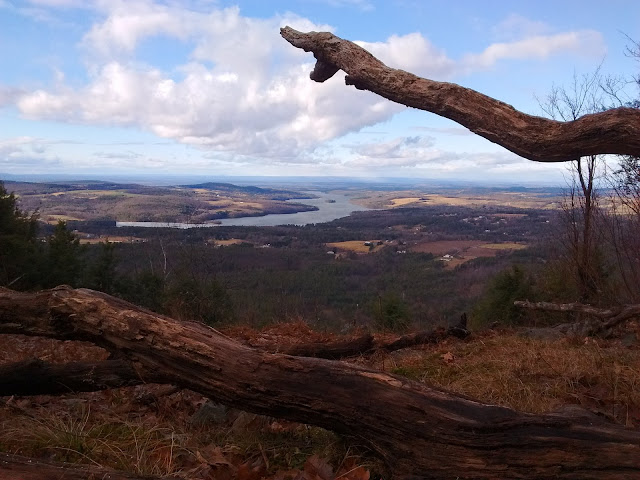
Changes at Rensselaer Plateau Alliance's Grafton Forest so I revisited a couple times. There are 3 lookouts, all toward Tomhannock Reservoir, and a maze of logging roads. ~10 miles east of Troy.
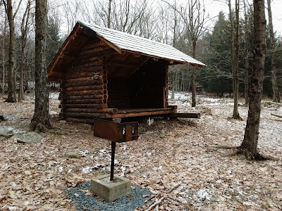
 The Whoop-De Do Trail (white markers) is a 1.4-mile multi-use trail - ruts, rocks & puddles - not the prettiest. Valley View Trail (yellow) is most interesting & more like a regular hiking trail - some steep to very steep & rugged parts, leads 0.4 miles to a lookout at 1,500' elevation - Empire State Plaza can be seen to the W, northern Taconics to the NE, Adirondacks on a clear day. Passes a balancing rock & some nice hemlock woods. After 1 more mile reach Vulture View - again Tomhannock Reservoir dominates, a bit closer here. Another 0.5 miles on Vulture View Trail (orange) on logging roads to loop back to white trail, 0.7 miles back to parking area. 0.4 miles further NE on white trail is the Rynard's Roost Trail (blue, logging road) which, after a steep section, leads to another lookout at 0.5 miles (fire pit & grill here for you hiking BBQers), then continues SE into Pittstown SF at 1 miles. Into the SF for a bit then sharp R (red ribbon on tree is the only marker I saw), back into GF, bear R & pass lean-to site. Nice lean-to built November 2017 as Eagle Scout project - Scotch? pine logs, cedar? roof shingles, could be deeper (side-walls are only 6' front to back), no privy or fire ring but does have a raised grill, faces west (gets prevailing winds) overlooking a wetland (oligotrophic dimictic lake) with much phragmites. Red oak is the dominant tree but there are many other types with a mix of lowland & upland species. The Highpoint Trail (red) is a nice new hiking trail to ~1,580' where there are occluded views in winter. Wanted to do a loop, I bushwhacked 0.8 miles to the lean-to. There are maps posted at each junction but the red trail is not shown on those. Map & more info: https://www.rensselaerplateau.org/gundrum-land .
Expect some ATV & snowmobile use on white, orange & blue trails. Elevations 1,200'-1,600'. Winter use after snow: Stuffle St parking area gets plowed just by a volunteer, not sure if he will be able to plow this winter or not - the last half mile of dirt road is rough, even in summer, so leave the Carrera at home.
June 25, 2017 - GRAFTON FOREST hike. Rensselaer Plateau Alliance has recently marked a couple of trails on the former Gundrum property in Grafton. From Rt.2 drive 2.5 miles on Stuffle St to the new trailhead, the last half mile is a rough dirt road. State Forest Trail (white) for a quarter mile then L on Valley View Trail (yellow). The trails are on nasty logging roads with some mud & puddles & I had quite a few black flies buzzing about my head. A lookout is reached in under a half mile - nice breeze & bugless so I could enjoy the view & eat lunch; elevation 1,500'. Tomhannock Reservoir, Troy's water supply, is in view & there are distant views to the Green Mtns. Could see but not hear traffic on Rt.7. Short side-trip further along State Forest Trail to get a feel for things. 1.9 miles, elevation gain a little over 100' - good reward for little effort.
Visit us on Facebook


Comments
Post a Comment