CAPE COD kayaking


Sep 11, 2015 - WALKERS, UPPER & LOWER MILLPONDS from Slough Rd in Brewster. Wanted to paddle Chase Garden Creek but the bay was real choppy, so to plan B. Wind 10-20mph from the N. Freshwater kettle ponds, lightly developed, some conservation lands. Did each pond clockwise. Shallow passage from Walkers to Upper (the biggest of the ponds). Narrow (down to 3') 250 yard passage to Lower & grist mill/dam. Wind & bouncy waves on return. Green & gb herons, osprey, swans (1 cygnet). Drove over to Coast Guard Beach & walked S on Nauset Spit over 1 mile to Nauset Inlet, saw over a thousand seals. Sunset at Rock Harbor.


Sep 10, 2015 - LITTLE PLEASANT BAY from landing at end of Portanimicut Rd in Orleans. Forecast for rain in pm, light wind. Started at mid flood tide. Past Seal Rock & across to Hog & Sampson Islands. Around S side, eelgrass in water, then N on shallow Broad Creek (best done closer to high tide) with barrier dunes & Atlantic Ocean to the E, snowy egrets in shallows. Saw fog rolling in (I have a Brunton deck compass) so crossed over to Old Field Point then across to Namequoit Point following shore back to landing. Continued S to Sipson Island with short break at Eelman's Point, saw seal. Back to landing & into tiny Paw-Wah Pond, heard thunder. 6.6 miles, 2 hrs. Visited several beaches in the rain, not many people - used inexpensive highly waterproof/breathable umbrella.

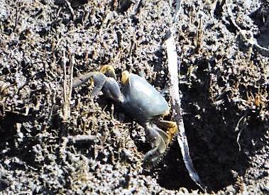
Sep 9, 2015 - HERRING RIVER from Rt.28 in West Harwich. Good SW wind, hot. Start just before high tide for the sound. Side-trip 0.6 miles up Coy Brook to low bridge. Back to HR. Side-trip into East Reservoir, green herons. Continued upstream on HR under 2 bridges to West Reservoir. Quick return with current. Swans, osprey, red-tailed hawk, yellowlegs, sandpipers, gb herons, cormorants, kingfishers, fiddler crabs, black snake. 8 miles, 3.5 hrs.

Sep 8, 2015 - BARNSTABLE HARBOR from Blish Point state boat launch. Hot, humid, light breeze. Sandy Neck is a 7-mile-long barrier beach on Cape Cod Bay with 2nd highest dunes on Cape Cod. Paddled 1.5 miles to the old lighthouse then to Beach Point at the tip. Back W, good look at The Dromedary dunes, around N side of marshy Great Thatch & Little Thatch islands then up Wells Creek - I could feel the ebb current & turned around then across harbor S of Phillis Island. 8.8 miles, 2.6 hrs (no breaks).

Sep 7, 2015 - WASHBURN ISLAND from Whites Landing in Falmouth. Down Childs River, L on Seapit River to Waquoit Bay. Had to go wide around 2 shallow spits as I paddled down the E shore of Washburn Island & past some campsites. Over to the narrow inlet for a break then over to Tom's Pond. Short walk across dunes past rugosa rose with hips to the Sound - stiff SW wind creating good waves here, Martha's Vineyard seen 5 miles out. Crossed Tom's Pond to 200' portage to Eel Pond then N to Childs River. Lots of osprey, gulls, cormorants. 8.4 miles, 4.7 hrs. Drove over to the Estuarine Preserve & hung out on an Adirondack chair on top of bluff with view of the bay - learned that in 2012 there were 37 nesting pairs of osprey in the bay area.


Aug 20, 2012 - BASS HOLE area from Grays Beach in Yarmouthport, Cape Cod. Walk on boardwalk across marsh. Fiddler & green crabs. Light S wind. Launched 4 hours before high tide & there was a good current to paddle against to get out onto Cape Cod Bay. The bay was quite calm with clear water & shallow areas. Paddled SW toward Barnstable & then NE past Chapin Beach. Dunes closed off to allow for nesting terns & plovers. Back thru the inlet & up Chase Garden Creek. Look carefully for the miniature flowers of sea lavender. Bass Hole area probably best 2 hours either side of high tide to avoid max currents.


Aug 19, 2012 - POPPONESSET BAY near Mashpee on CAPE COD. From town landing on Ockway Bay off Great Neck Rd. Across the bay & into Fullers Marsh - great egret, little green herons. Out thru the inlet & onto Nantucket Sound. N wind 5-10 knots, waves up to 1'. Popponesset Beach - lunch & swim on almost a mile of undeveloped beach. Across the bay & up the Mashpee River - some development at 1st but soon into conservation land. Large quantities of osprey. Some motorboats - there is a narrow deep water channel across the bay. Dagger Alchemy, a most versatile & fun 14' touring kayak.
Sep 12, 2011 - BARNSTABLE HARBOR. Sandy Neck. Scorton Creek.
Sep 11, 2011 - WAQUOIT BAY. Washburn Island. 
Sep 10, 2011 - SOUTH BEACH. Morris Island. North Monomoy Island. Grey seals, coyote.. 
Sep 9, 2011 - NAUSET MARSH.
Lunch at the inlet next to a sculpture of found objects. Grey
seals. Sunset from Rock Harbor. 1+ hour walk on Coast Guard
Beach under moonlight. 


Sep 8, 2011 - LITTLE PLEASANT BAY. The River. Sampson & Hog Islands.
Sep 7, 2011 - CLIFF POND. A quickie in Nickerson SP.
Sep 13, 2010 - Morning ocean beach walk at Coast Guard Beach down to Nauset Inlet - lots of seals in the water. SANDY NECK in Barnstable. Cape Cod Bay paddleable here well away from high tide. 2nd highest dunes on the Cape on 7 mile barrier beach. Chop up to 1'.
Sep 12 - CAPE COD. Camping at Nickerson SP - get your reservations early. Early morning paddle around CLIFF POND in the park, 1 windy hour, some nice beaches, very clear water. High tide ~3pm so needed to kill some time. Hung out at Head of the Meadow Beach on the ocean side & then at Mayo Beach on the bay side in Wellfleet. Launched into CAPE COD BAY at Sunken Meadow Beach. N past Audubon Sanctuary (mostly undeveloped). Lieutenant Island Rd, which joins the island to the mainland, floods at high tide so I paddle across the road, the bridge now an island. Into Loagy Bay, I pass a boatload of cormorants. Around LIEUTENANT ISLAND then explored an unnamed creek just N of Fresh Brook before returning. Watched the sunset from First Encounter Beach.
Aug 4, 2008 - CAPE COD NORTH MONOMOY ISLAND near Chatham, MA. W winds 10-15 knots. Launched from N end of Morris Island Rd causeway, 200' carry to water. Osprey with nest next to road. S on the W side of South Beach, across to N end of South Monomoy then back along E side of N Monomoy - whole area may be referred to as The Southway. Walked across South Beach to the Atlantic (Enjnir saw a gray seal). Development on Morris Island, rest undeveloped & managed as wilderness. Tons of gulls & other shorebirds - greenhead flies kept our lunchstop on NM short. Launched ~3 hours before high tide, returned a little after high. Some light motor traffic stays in the marked deepwater channel; a lot of this area is shallow. 9 miles, 4 hours. Wilderness Systems Zephyr kayak worked out really well. 


Aug 3 - CAPE COD BAY. Winds NW 10 knots early, calm in the afternoon. Launched from town landing at end of Old Wharf Rd (part of road floods at high tide, park at a high spot) in Wellfleet. Around W side of Lieutenant Island - surfed some 1.5' waves. S along undeveloped shores of Massachussetts Audubon - marshes, paddled S up a stream all the way to hiking trail bridge, very narrow at the end. Out & S a bit to deserted beach for lunch & swim in the warm water - no bad bugs. N under causeway bridge E of Lieutenant Island (road flooded on both sides at high tide). Into Loagy Bay, past Old Wharf Landing & N toward Wellfleet Harbor before turning back. Views across to the dunes of Great Island. Nice variety. Osprey, gb herons, hermit & horshoe crabs. Motors stay far from shore. 10+ miles, 5.3 hours. Camped at Nickerson SP - grilled swordfish, tuna & scallops over the wood fire - mmmmmmmmmmm.


Oct 8 - Oct 12, 2007 - CAPE COD kayaking. Camped at Nickerson State Park. Small craft advisories & gale warnings all week. Water temp ~65. Swift Saranac 14, a 14' touring kayak. Cobra MR HH 90 VHF/weather radio.
Oct 8 - Launched mid-tide (incoming) at end of Paines Creek Rd in W Brewster. Headed up narrow, marshy PAINES CREEK for under a mile to Rt.6A. Back & out onto CAPE COD BAY along undeveloped Wing Island then into wide & winding QUIVETT CREEK then returned. Nice area with sandy beaches, small dunes & not too much development. Nighttime 4 mile walk on Coast Guard Beach on the Atlantic Ocean.
Oct 9 - LITTLE PLEASANT BAY in Orleans. Put in at end of Barley Neck Rd - very muddy at low tide. E side of bay is in National Seashore & has minimal development. Down Barkers Creek (wide & shallow), alongside Pochet Island, around W side of Sampson (sandy bluffs) & Hog Islands then SE to Nauset Beach.. Walk across narrow section to ocean - seals in the surf. Returned with side-explorations of Broad Creek & Fox Jump Creek E of the islands - best done closer to high tide. Only saw 1 small motorboat. I'll be back. 9 miles, 4.5 hrs.
Oct 10 - NANTUCKET SOUND from Red River Beach in S Harwich - relatively calm with land blocking the NE winds. Side-trip into Taylors Pond. SE past Hardings Beach. STAGE HARBOR in Chatham - windy, waves to 1'. Watched as they unloaded bags of shellfish at Chatham Fish Pier. Large school of fish feeding with tail fins sticking out of water - interesting sight. Groups of white-winged scoters on the sound. 11 miles, 5 hrs.


Oct 11 - BASS RIVER in Dennis. Follins Pond to Rt.28 with the outgoing tide & the wind at our backs. A bit too much development for my tastes - good birding tho incl. osprey & swans. 6 miles, 2 hrs. Hiked trails around Fort Hill in Eastham overlooking Nauset Marsh & thru Red Maple Swamp - watched a northern harrier play with the wind.
Oct 12 - HERRING COVE BEACH, Provincetown. Very windy, wind from ENE, beach faces SW. Paddled along beach to Hatches Harbor - Race Point Light closeby. Trio of loons, seal, billions of gulls. View of P'town Monument on way back. Also walked Atlantic beach at N of Highland (big surf) & bike trail near Race Point (good mushrooming).

Oct 13-16 - CAPE COD kayaking. Camping at Nickerson SP. Had to work around low tide on coastal trips.. P&H Quest, a 17'7" sea kayak.
Oct 16 - POPPONESSET BAY. Launch at Pirate's Cove Town Landing in Mashpee. N up Shoestring Bay to bridge then back to P Bay. Out into Nantucket Sound a little before low tide - a shoal is avoided by staying close to W shore. Along the sound & undeveloped beach for a mile before coming back & relaxing on the beach. Martha's Vineyard & the Monomoy Islands visible. Back inside the bay around slack tide then thru canal-like Popponesset Creek which is very developed with nice homes. 9 miles.


Oct 15 - GREAT ISLAND. Launched on Herring River, Wellfleet. 10-20 knot W winds shielded by Great Island (actually a long undeveloped peninsula, National Seashore). Jeremy Point out on tip looking out onto Cape Cod Bay. Lots of dead ducks on beach. Waves up to 1.5' when returning with tide coming in + tailwind. 10 miles.

Oct 14 - NAUSET MARSH. Town landing at Hemenway Rd in Eastham. NE toward Nauset Bay then cut into Creek C/Beach Channel with dwindling water as tide was going out. Out into Atlantic Ocean a bit but turned before reaching some good surf. A BCU kayak class spent much time in those waves. Seal. S thru Nauset Harbor & Mill Pond then back to start passing Fort & Skiff Hills. 9 miles.

Oct 13 - WALKER UPPER & LOWER MILL PONDS. Town Landing on Slough Rd in Brewster. Did perimeters of all ponds - lightly developed, freshwater kettle ponds. An opening of a few feet between Walker & Upper. A 100 yard narrow twisty shallow channel between Upper & Lower was a bit of a workout with a long boat. Mill at NW of Lower Mill Pond. Swans, turtle. 5.5 miles.
Oct 18, 2004 - POPPONESSET BAY kayaking. Put-in at low tide at town landing on Ockway Bay in S Mashpee. Forecast for WNW winds 10-20mph but not too bad as long as I stuck to W side of bay, sunny again. Went up MASHPEE RIVER about 2 miles - water got very shallow - some houses at first but just woods as one enters the Mashpee River Woodlands. Red-tailed hawk. Back on bay paddled down to Popponesset Beach, an undeveloped barrier beach almost a mile long - relaxing lunch & walk. Returned along Popponesset Creek which has much devlopment & explored a couple of dead-end channels.
Oct 17 - GULL, HIGGINS, WILLIAMS PONDS - kettle ponds in Wellfleet. 20-30 mph winds but sunny. Ligthtly developed shores mostly in pitch pines. Channels connect the 3 ponds. 2.7 miles, 1+ hrs. MARCONI BEACH walk - seals & surfers. The high dunes helped block the wind. NAUSET MARSH not too bad as long as I didn't venture too far from land - could see big waves on the ocean. Best to paddle here within 2 hours of high tide at Nauset Harbor. Put-in at end of Hemenway Rd in Eastham. Paddled N & into Salt Pond below National Seashore's Visitor Center then thru Big Box, NW Passage & Skiff Hill Creek below Fort Hill, which has a nice walking trails with views of the marsh.
Oct 16 - CAPE COD kayaking. SCORTON CREEK in Sandwich. 20-30 knot winds but sunny. Put-in just S of Rt.6A. Paddled downstream to within sight of Cape Cod Bay. Tide coming in fast. Back past put-in, exposed grassy shores, hard to get away from wind. Northern harrier. With the incoming tide & tailwind, able to go 4mph without paddling. Creek narrows & I branch S into Shove Creek til grasses are 10' above my head & creek is very narrow. Back to main creek & upstream again to road bridge. Returned at high tide, water now overflowing banks & creating a lake-like body of water - very interesting. Go 2mph paddling hard into the wind keeping an eye out for the deep main channel. Dagger Catalyst 12.8 , a 12'10" plastic rec/tourer w/rudder - very good primary stability (good for photography but kayak rocks more with beam waves), very good tracking but rudder does help in high wind & currents, surprisingly good speed (cruises nicely in 3-3.5mph range) for a kayak of this length, comfort was better for me with lumbar support deflated, very light weight for plastic kayak with 2 hatches - excellent beginner to intermediate kayak. Best Cape Cod guidebooks: Paddling Cape Cod by Bull & Adventure Kayaking Cape Cod & Martha's Vineyard by Weintraub (both usually available at APnP).
Oct 9 - SANDY NECK, CAPE COD BAY kayaking. Put-in at Sandy Neck Beach at end of Sandy Neck Rd in West Barnstable. Sandy Neck is an undeveloped 6 mile spit & has the 2nd highest dunes in Cape Cod. Paddled along the shore almost to its tip in light off-shore breezes & warm temps. 10 miles, 5 hrs. Camped at Shawme-Crowell SF in Sandwich - convenient for exploring the Upper Cape.
Oct 10 - WAQUOIT BAY kayaking. Put-in on the Great River in Mashpee. Pass Little River & into bay. Bay averages about 5' in depth. Poke in to Sedge Lot Pond at high tide & take a short walk to South Cape Beach on Vineyard Sound. Back out into the bay going clockwise. Out onto the Sound thru gap at end of Dead Neck - Martha's Vineyard is easily visible 5 miles away. Back into Bay (inlet was very choppy from boat traffic; could be even choppier & dangerous when wind opposes the tidal current) & along undeveloped Washburn Island which has 11 backcountry campsites in pitch pines with sandy beach (another trip idea). Winds 10-15 knots at mid-day created some 1' waves. N end of Bay has some development & we paddle thru moored sailboats. Entered the Moonakis/Quashnet River & go up about a mile before it got too shallow - some good fall colors here. Watched a cormorant attempt to feast on a fat fish it had caught. Back to put-in. 11 miles, 6hrs. MAP.. Dagger Specter 15.5 , a 15'3" touring kayak made of Airalite ABS plastic (most plastic kayaks are made of polyetheylene) - primary stability good enough for photography, rocks a bit in waves but nothing major; secondary stability excellent, firms up nicely on edge, playful; maneuverability good; tracking very good, needs rudder in beam seas; (wind/waves from the side); not particularly fast for a kayak of this length; Airalite is extremely durable & has the good-looks of composite construction.
Oct 11, 2004 - SANDWICH HARBOR walk. Forecast for 20-30 knot winds from NW with gusts to 40. Start at end of Boardwalk Rd. Walked over bridge over Mill Creek & boardwalk over the marsh to Cape Cod Bay. Waves on bay were 5'+ & wind was intense. Walked to the gap where Mill, Dock & Old Harbor Creeks meet & exit into the bay. Back along edge of Mill Creek where we watched Enjnir fight the wind for an hour in his kayak. Drove over to Vineyard Sound to SOUTH CAPE BEACH in Mashpee. Sound looked much calmer than Cape Cod Bay even tho the wind was quite noticeable. Still in the mood for walking rather than kayaking. 3.5 miles of mostly undeveloped beach. Walked E some & took a siesta then W to end of Dead Neck with nice views of Sedge Lot Pond, Waquoit Bay & Vineyard Sound along the way.
Oct 12-15 - Cape Cod kayaking: A good map to have is the Trails Illustrated Cape Cod National Seashore - waterproof & tearproof. Best ref is Weintraub's Adventure Kayaking: Cape Cod & Martha's Vineyard altho I still used 4 other ass't guidebooks (we stock many guidebooks for paddling the E coast states from Maine to Florida).
Oct 15 - Pamet Harbor kayaking, N Truro. Some short hikes.
Oct 14 - Herring River, Harwich. Winds 20-35 knots.
Oct 13 - Nantucket Sound, Red River Beach, S Harwich to Chatham. NE winds 10-15 knots. Followed the coastline E past lightly developed shores. Water fairly shallow - could often see bottom. Could see the Monomoy Islands in the distance - the water shimmered in the ever-increasing sunlight. Stopped halfway down Chatham's Harding Beach for a break - beach is on one side of a peninsula, the other side is salt marsh, roses grow on the small dunes inbetween. We paddle past the opening into Stage Harbor & around the S side of Morris Island (actually a peninsula). Water shallow at low tide & I run aground once. Spot a seal which keeps an eye on us. Stop at Monomoy HQ for a break - a trail here gives one the opportunity to stretch the legs. Only the S end of Nauset Beach (a spit/peninsula) separates us from the Atlantic. Turn back & duck thru the gap into Stage Harbor - watch out for yachts, fishing boats, etc. thru here. See 5 other kayakers - 2 are heading out thru the gap without their PFDs on - I feel like saying something, but don't. Turn NW into Oyster Pond River on the marsh side of Harding Beach, poke into a couple of the tidal channels & take another break in a grassy spot dotted with clumps of roses. I lay back, body & mind become so relaxed & it is hard to move on. Continue on NE up the river past many moored boats & into Oyster Pond where we had earlier spotted a car (Stage Harbor Rd, 0.1 mi. SW of RT.28 rotary.) Susquehanna not severely tested today - just cruised along nicely.
Oct 12, 2002 - Cape Cod Bay from Wellfleet Harbor. Nautical Forecast called for winds from the E of 20-30 knots - bring a weather radio. Tide Charts tell us that low tide expected about mid-day. Put-in at the beach on Shirttail Pt. Would liked to have paddled to Great Island & Jeremy Pt. but winds would make for a rough return so we headed S along Indian Neck. Watched clammers at work. Double-crested cormorants are seen often. Around Field Pt. we are more exposed to the wind + in shallow water so we turn around. Turning E into Wellfleet Harbor we push against wind & waves then turn N into Duck Creek which we follow for quite a ways (almost to Rt.6). We pass Cannon Hill with its pitch pines & minimal understory. At times the creek narrows to a few feet & we have to push aside the overhanging cordgrass to get thru. Thousands of 2" long brackish water fiddler crabs scurry upward as the tide comes in - fun to watch. Impex Susquehanna, a 16'6" fiberglass touring kayak, was surprisingly easy to manouver thru the winding creek - occasionally dropped the skeg for better tracking in windy spots. Stopped at the National Seashore's Coast Guard Beach on the Atlantic side & hiked S 2 miles - breaking waves were huge - walking on sand & returning into a headwind takes more work than walking on solid ground & after 4 miles you know you've had a bit of a workout.


Comments
Post a Comment