Posts

Showing posts from June, 2018

APPALACHIAN TRAIL sampler in CT

Image
Appalachian Trail in the area of Kent and Cornwall Bridge CT.  An easy (get-in-shape) backpack on the River Road section, S to N.  Gate (closed May-Sep) near trailhead for St. John's Ledges to Stewart Hollow Brook Shelter & Campsite 2.3 miles, camped here, user friendly, el 400', fair amount of road noise.  Nice walking alongside the Housatonic River - mostly deciduous trees.  Abundant birdsong, variety of birds.  Lightly used railroad on other side of river, Rt. 7 not too far away.  Stony Brook Campsites at 2.7 mi.  AT pulls away from river & goes along edge of grass/clover field.  Road crossing at 5.4 miles.  Climb 500'.  Silver Hill Campsite at 6.3 miles, el 900' - camped here - unique with pavilion, 3 picnic tables, well pump for water, a bench swing & observation platform - almost glamping but little privacy, some pines.  Lots of motorcycles heard on nearby Rt.7 on Sunday, quieter on Monday.  Went a bit further...
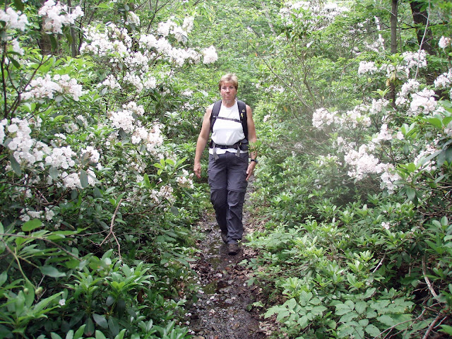
Mountain Laurel

Image
It's that time of year again - mountain laurel season, blossoms in mid-June. Mountain laurel can be found in areas south of I-90 (Catskills, Taconics, Gunks, Litchfield Hills, etc.) at elevations between 500' and 2,500'. June 2018 - GUILDER POND in SW MA. June 2018 - BEAR MOUNTAIN in NW CT. June 13, 2016 - SOUTH TACONIC TRAIL EXTENSION hike (can't sit on our butts all the time), from Quarry Hill Rd to Shagroy Rd near Millerton. Mid-June is mountain laurel blossom time S of the Capital District. Temp in 60s & windy. Very steep climb from QH Rd, gaining 900'+ in 0.8 miles (965' elevation to 1,900' at 1st lookout). Several lookouts along the way, mostly to the west & Catskills. Slow loss of 1,000' going south. Saw a racoon climb a tree, eastern towhee; no bad bugs. 7.7 miles, 5.8 hours. Short drive to trailhead for Bash Bish Falls - start in NYS, falls are in MA. 1.5 miles. http://www.nynjtc.org/content/south-taconic-trail-extension ...

NEWCOMB LAKE & CAMP SANTANONI, Adirondack Park, skiing, hiking, camping, paddling.

Image
Dec 23, 2021 - Skied into the camp on 5"-8" of snow.  +Quite well tracked out by other skiers this week.  Saw 9 other skiers.  Temp rising thru the teens & wind-chill at the camp.  Visited the boathouse which is always open.  10 miles, 4 hours. Sep 2-4, 2017. NEWCOMB LAKE. Backpacked in on the smooth dirt/gravel/horsepoop road. 4.9 miles to the boathouse of Great Camp Santanoni. Boat pickins were slim - I borrowed a 17' Ward's Sea King aluminum canoe. Most of Newcomb Lake is in the High Peaks Wilderness Area. There are 8 campsites near the great camp - there are 2 lean-tos in the W half of the lake which you don't see from the great camp. Paddled to Ward Pond Brook lean-to, nice views of 4,606' Santanoni Peak along the way; small beach landing, shallow sandy bottom was nice for a swim, view of 2,838' Baldwin Mtn. Took 3 hours from the car. Paddled around the W end of the lake - could see Marcy. Poked up the inlet to the W. The cano...