BALDHEAD & MOOSE MOUNTAINS bushwhack hikes in the Wilcox Lake Wild Forest
More info in ADK's Eastern Adirondacks guidebook & lots of info in Bill Ingersoll's Discover the Southern Adirondacks guidebook.
Oct 5, 2023 - MOOSE MOUNTAIN hike, in the eastern Wilcox Lake WF near Stony Creek. Originally, I was planning to start on Tucker/Brannon Rd & bushwhack all the way past Burnt Mtn & Welch Vly, but after consulting with a friend & reading the description in Bill Ingersoll's Discover the Southern Adirondacks (Ingersoll states "Permission is given to walk this road to the property of Dominick Di Lorenzo and cross his private lands at the end of the road to state land." We did chat with 2 people driving up on an ATV & they said nothing negative. We decided to start (1150' el) by walking up Bit & Bridle Rd, a rough at times 4WD road with several camps along it. Both sides of the road are posted.
Driving from the E, we saw a sign on Brannon Rd: bridge out 1/4 mile, so we drove into Stony Creek & headed up Tucker Rd where there was a similar sign but we kept going, past a barrier, & the road was ok to Bit & Bridle.
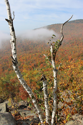
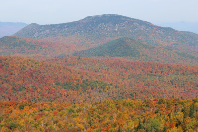
Walked up the dirt/rock road for 1.3 miles, gaining 600' - nice views of Twin Brooks all the way. Took a R up an old logging road, soon entering state land, to a ridge then turned N - there was some old flagging here. Soon started coming out on open rock slabs with views S & W - could see Hadley & other mountains rising up above the fog on the lowlands - sweet! Oaks & beech with some maples broke up some of the open rock. Went over a small bump at 2 miles & turned NW. Fairly easygoing with many open rock slabs, 1 very steep spot but there was a diagonal route across. Some spruce around the summit area (2831'). By moving around a bit we found views in all directions. Baldhead (hiked May 10) & Crane Mtn stood out nearby. Gore a bit further & the High Peaks way in the distance. Spent over an hour absorbing it all in. Went down slightly W of our up route which ended up shorter but missed the open rock & views. 5.7 miles, 1798' gross el gain, 4.6 hours.
May 10, 2023 (Wed) - BALDHEAD MOUNTAIN bushwhack from the height of land (1275') on Tucker Rd, near Stony Creek. East part of the Wilcox Lake Wild Forest. Started climbing moderately on a path (markings soon ran out) thru hardwoods. Climbed a bump (1985', below the 2000'+ top) at 1 mile, then dropped 150' thru hemlocks before a very steep climb up Baldhead - open hardwoods again + rock slabs with views S to Hadley Mtn. Higher up, occasionally had to go thru spruce/fir to get to the next open rock area. Super views near the summit (2868') were best to the N & E. Just a tiny bit disappointed that I could not see Garnet Lake & had to make do with close views of Crane & Moose Mtns, & distant views to the High Peaks & VT. Route down was slightly W of our route up & we avoided going up "the hump" by skirting it to the W. Moderate (fewer than 50 around me) black fly swarming but still not biting (I had sprayed a little DEET on the back of neck, hands, & wrist). Temp rising thru the 60s. 4.6 miles (felt like twice that), 1818' gross el, 5.8 hours (moving time was close to 4 hours). Will have to come back sometime to do Moose Mtn which has more open rock than Baldhead.
Crane Mountain:
Moose Mountain:
.JPG)

.jpg)


.JPG)
.JPG)
.JPG)
.JPG)
.JPG)
.JPG)
.JPG)
.JPG)
.JPG)
.JPG)


Comments
Post a Comment