RAYMOND BROOK TRAIL skiing, IVES DAM & RABBIT POND
.JPG)


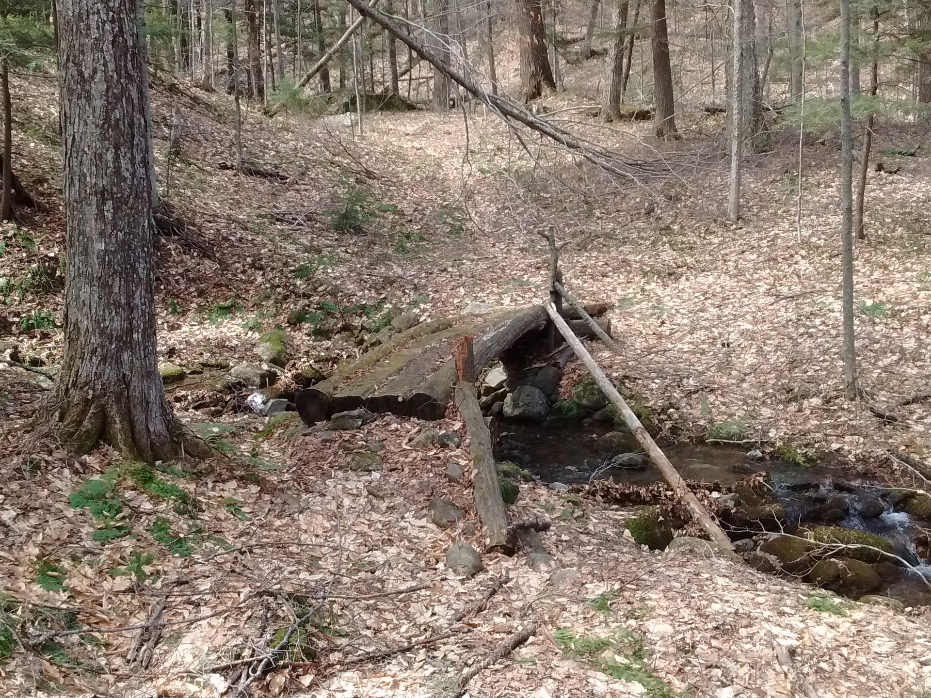
Apr 11, 2023 - IVES DAM xc ski, from Barton Mines Rd (2100' el) N of Gore Mtn. Checked out the Halfway Brook Trail (Siamese Ponds Wilderness) first but the bridge over the brook was out so we turned back after skiing just 0.5 miles - old ski tracks were icy hard, but skiing was good when on virgin snow. Up the Raymond Brook Trail (Vanderwhacker Mtn Wild Forest) - 3 bridges had narrow spines of snow, don't like but made it across without falling in the water. SE on an unofficial trail that goes around the N side of Pete Gay Mtn - goes thru unposted private land, just behave - thru-the-trees views to the N & E - very good skiing. Steep up & over a shoulder of PG Mtn & down to power line & ID - warning, some bare spots & water near the bottom. Explored further. Topped out at 2900'. Back the same way. Skiing should be good here for the next day or 2 - after that, brook crossings could be a factor. Up to 20" of snow, temp rising thru the 50s. 7.3 miles, 4.5 hours..JPG)
.JPG)
.JPG)
.JPG)
.JPG)
.JPG)
.JPG)
.JPG)
.JPG)
.JPG)
.JPG)
.JPG)
.JPG)
.JPG)
April 20, 2022 - IVES DAM ski. Hadn't skied in a month due to lack of snow but yesterday's storm was a big one & it dumped a lot of snow at higher elevations. So I thought it would be best to head for higher elevations. Started out from Barton Mines Rd & headed up the Raymond Brook trail to height of land - temp was 31°F & there was a breakable crunchy surface (frozen sleet?) to break trail thru (there were 4 of us to do the work) - the skis still sunk in 6-8". Took a R on an unofficial trail that leads to Ives Dam, a couple of good uphills along the way & some thru-the-trees views to the High Peaks, which is also on the Schaefer Trail to Gore Mtn. Found a spot for lunch, then explored the area. Temp rising thru the 30s, skiing back on our tracks was nice but fast on steeper parts, untracked snow was heavy & dense. 15"-20" of snow, should last thru the weekend. Elevations between 2,100' & 2,900'. 6.1 miles, 1,050' gross elevation gain, 5 hours. The parking area was not plowed when we got there so had to park roadside - when we got back after the ski the parking area was plowed.


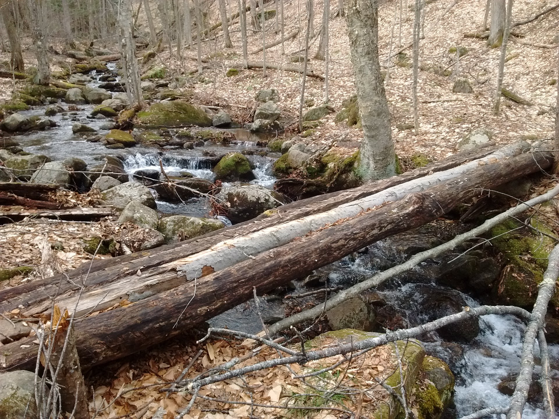
Apr 25, 2019 - RAYMOND BROOK & RABBIT POND hike, from Raymond Brook Ski Trail trailhead (1,060') on Rt.28 in North Creek. Vanderwhacker WF. Blue markers, a gain of 450' in 1st 0.7 miles to a 4-way junction. R on RBST for 2 miles, gaining another 450' - easy rolling terrain at 1st then a bit more uphill. Crossed a trib on a bridge, handrail has fallen off. RB now close down in ravine, always in earshot, sometimes in view. Reached historic sled shed & 2nd bridge over a trib, handrail has fallen off too. Back to 4-way jctn. R on Rabbit Pond Ski Trail, moderate uphill at 1st then steeper, pond reached in 0.9 miles (400' gain). Triple set of beaver dams - I wonder what they were thinking (small ponds for the kids?). Back down half way then R on steeper way down (red markers, wide trail). Reach yellow Ski Bowl Connector Trail, took L. Soon pass a beaver pond, lose trail at other end but soon get back to 4-way - took a R & back down. Yellow violets. No snow. 7.7 miles, 4.7 hours.


Mar 18, 2017 - IVES DAM & RABBIT POND ski, from Barton Mines Rd (elevation 2,100'). Up on Raymond Brook Trail then R on path N of Pete Gay Mtn. High Peaks view. Climb to over 2,700' before dropping to Ives Dam (2,600'). Easy downhill on Schaefer Trail - across Roaring Brook could see skiers & lift on Gore Mtn. North Creek Reservoir. Brief climb to 2,300' before dropping steeply to Rabbit Pond (1,900') - twisty but wide, lots of fun. More twisty steeps down to junction with Raymond Brook Trail. R on Ski Bowl Connector Trail (not as steep but can get some speed up) down to North Creek Ski Bowl. Elevations 1,050' to 2,700'+. 15"-20" powder on some base - good to excellent skiing; some sun-baked areas & post-holes made by a dog. Whitetail deer. Over 2,100' gross downhill, 900' gross uphill with car shuttle. 7.1 miles, 4.1 hours.


2018 - SAVE RABBIT POND!!! Looks like the state wants to take some land from the Vanderwhacker Wild Forest and add it to the Gore Mtn ski area. Initially, it looked like that would include Rabbit Pond and the trail that goes past it - this trail has been a great xc ski run and as much fun as the nearby RAYMOND BROOK SKI TRAIL which it connects to. It looks like the preferred alternative #3 will save Rabbit Pond but the trail below the pond will have to be rerouted somewhat (200 yards of new trail?). This is on the APA's agenda for June 7 meeting. (note: we saved it!!!)
2018 - "Adding the area around Rabbit Pond into the Gore Mountain Intensive Use Area would provide the opportunity for ORDA to construct a ski lift from the base of the Ski Bowl to a point high enough on Little Gore that would allow skiers to ski to the west to the Rabbit Pond Trail, ski on a section of the Rabbit Pond Trail and then tie into trails that return to the base of the Ski Bowl." - This is in the Gore Mountain UMP Amendment. The land would have to be reclassified from Wild Forest to Intensive Use first. THIS SHOULD NOT BE ALLOWED - the trail above and below Rabbit Pond is in the same area as the Raymond Brook Ski Trail and one can connect the two for some great backcountry skiing.
Feb 11, 2015 - RAYMOND BROOK & RABBIT POND. Spotted a car at the Ski Bowl & drove up to the trailhead on Barton Mines Rd. Ran into Ron Kon & retired ranger Steve Ovitt at the intersection.


Visit us on Facebook


Mar 26, 2014 - IVES DAM from Old Farm Trailhead. Gain 500' on Halfway Brook trail passing jctn to Botheration Pond then dropping over 200' to The Vly with its view of Gore Mtn. (Coyote trapping in this area - keep your dog on trail). Crossed Barton Mines Rd to Raymond Brook trail to top of pass. SE on unofficial trail (some old markers) around N side of Pete Gay Mtn with expansive view toward the High Peaks - mostly rolling terrain with 2 steeper uphills, the 2nd is wide & likely was an old ski trail. After gaining 700' from The Vly the spruce/fir-lined trail drops down 150' past a powerline & soon arrives at the site of Ives Dam (no more dam, Roaring Brook runs thru a clearing). The Schaefer Trail up Gore passes thru here, can also see some ski trails on Gore's N side. Great run back out, got in quite a few turns. Part of this trip goes along old trails of the Highwinds Ski Touring Center which has long been closed. Good to excellent skiing - a bit icy in old ski tracks, sweet out of tracks with few inches of powder on good base. 12+ miles, 5.5 hours.
Mar 18, 2013 - RAYMOND BROOK & IVES DAM from Barton Mines Rd in North River. Raymond Brook Ski Trail - 250' gain to height of land at 2,350' then I dropped 800' (intermediate+ in excellent conditions, initial drop of 300' is quite steep then "mellows" a bit) passing an old sled shed. Crossed 2 good bridges. Less powder down below so climbed back up (had climbing skins with me but did not need). From height of land skied SE on unofficial trail shown on this map (intermediate, a few assorted markers, goes thru unposted private land) around NE side of Pete Gay Mtn with views to the High Peaks (Mt Marcy's white dome really stood out), up an old wide ski trail to 2,750' el. before dropping past a powerline to site of Ive's Dam just to the N of Gore Mtn - the blue-marked Schaefer Trail to Gore Mtn goes thru here. Barton Mines tailings to the W. Nice run back to start. 2"-5" (more at higher elevation) powder on 1.5' of icy base - good to very good skiing - could have been perfect if there was 6" more powder. 4 hours.
Jan 26, 2009 - HALFWAY BROOK & RAYMOND BROOK TRAILS. Thru ski from Old Farm Trailhead to Rt.28. Climb over 400' on HB Trail, drop to The Vly & campsite with view of Gore. Cross Barton Mines Rd & pick up newly marked RB Trail which climbs moderately before dropping 1,200' in ~3.5 miles to Rt.28. Initial drop from height of land is steep but there is room to move & pick your best way down. Things moderate for ~2 miles, pass historic "Sled Shed" from the 30's, even some uphill. Raymond Brook in ravine to our L. Good new bridges over streams. Another steep section before Rt.28 parking area. Exhilarating! Intermediate+. 9 miles, 4 hours, 15 min. shuttle (one-way) between trailheads.


Comments
Post a Comment