Mar 27, 2017 - PLOTTER KILL PRESERVE from Lower Gregg Rd. Rain this morning, temp in the 40s means soft snow. Good skiing on up to 6" heavy wet stuff; faster in tracked areas, hard to turn on steeper hills. Rim of the gorge red trail past the 2 power lines then back. Had to go off-trail upstream to get across 2 streams. 2 hours.
Feb 25, 2017 - PLOTTER KILL PRESERVE hike from Coplon Rd. Day 3 of springlike weather, temp rising into mid 60s. NE on the wet & muddy red trail. After crossing a bridge over a tributary (which drops thru a steep narrow gorge) took a L on yellow then unmarked path steeply down to the PK passing thru red pine then white pine & hemlock woods, some ice down low, had to be careful not to slide into the roaring stream. Back the same way. 1.5 hours. Drove over to Mariaville Rd trailhead & walked down on icy trail to top of the 60' Upper Falls - all water, no ice.


Feb 18, 2017 - PLOTTERKILL PRESERVE ski, from Mariaville Rd (Rt.159), a Schenectady County preserve. Good skiing on 10" heavy wet snow. Looped on blue trail. Crossed the Plotter Kill on a bridge. Passed top of the Upper Falls. Down to Rynex Creek & top of falls. Had to go upstream 100 yds to find a good place to cross. Back on red trail, some steep downhills. Passed power line. Grade became easier. Scenic stretch on rim of gorge. Passed another power line. Turned around at trail to Lower Gregg Rd parking. Down to the PK on yellow trail for lunch. Back up red trail. Yellow trail traverse alongside Rynex Creek & back past Upper Falls. Trails tracked by snowshoers & bare-booters - no-one (except me) dares ski this! Less use below Rynex. Elevations 450'-900'. Temp rising into the 40s. 6.3 miles, 3.6 hours.


Dec 4, 2016 - PLOTTER KILL PRESERVE hike from the newer Lower Gregg Rd trail-head, room for 4 cars. A large Schenectady County preserve in Rotterdam NY with 3 waterfalls with drops of 40' to 60'. Yellow trail for almost half mile to red trail. Gently uphill at rim of gorge. Sound of civilization (NY Thruway) soon replaced by sounds of rushing water - PK ~100' down below. Crossed Rynex Creek above the falls. Yellow trail down to below Upper Falls for lunch. Over to top of Lower Falls. Took a couple of spur trails down to the stream on way back. Elevations ranged from 500' to 800'. 6.3 miles, 4.2 hours.


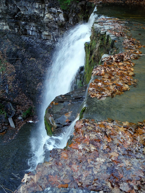
Oct 16, 2005 - PLOTTER KILL PRESERVE hike, Rt.159 Rotterdam. It's been raining for a week & what better thing to do than to visit 3 spectacular waterfalls all in one preserve. Blustery 50 mph winds rocked the treetops. The Plotter Kill drops 900' in its final 3.5 miles before emptying into the Mohawk River. 10 miles of trails in the preserve - one can easily spend a full day - pick up a good map at trailhead register. I visited the tops & bottoms of all 3 falls - some of the time on trail & some off - steep & slippery in spots. Continued downstream in bottom of ravine a ways. 3 hours.
Nov. 25, 2001 - Plotter Kill Preserve hike, Rotterdam. Predicted rain held off til after our hike; unusually warm (60s). Entrance is on Rt. 159, 0.4 mi. W of Coplon Rd. Followed red markers across the stream & to top of first falls which drop 60' over layers of shale & sandstone. Just a trickle today. Took a side trail which doubles back to bottom of first falls & also accesses top of second 40' falls. Plotter Kill continues for 2 mi. thru a box canyon. Continued on rim trail crossing Rynex Creek which also drops over a 40' falls before joining the Plotter Kill. Downstream, we cross the Plotter Kill & climb up the other side. Within sight & sound of the NY Thruway we drop 400' & cross back over to the N trail & head back, climbing 600' back to the trailhead. Falls can be truly spectacular in winter & spring & are not far from trailhead; we must have hiked 6 or 7 mi. in 4.5 hrs.


Comments
Post a Comment