PUFFER POND hike & ski in the Siamese Ponds Wilderness of the Adirondack Park
Update: Kings Flow trailhead is closed. From the new owners: "After much deliberation, we regret to inform you that the Chimney Mountain Trail head is temporarily closed to the public. Cabin at Chimney Mountain vacation guest can still access the trail head. On the night of 12AUG23 we had a hikers unleashed dog attack a cabin guests’ dog. This was a tragic situation where the attack dog grabbed the other dog by the neck and viscously shook it, taking 3 large adult males to separate the attack dog. This was only one of the many incidents we have had to manage to keep the trail head open through our private property. We purchased the Cabins at Chimney Mountain property in the spring this year, we are two people with no additional full-time staff managing 10 cabins and 280 acres. It was our full intention to keep the trail access through our private property open, however we are at the point where we feel it is our responsibility to keep not only our children and dogs safe but our cabin guests’ children and dogs safe. We have had multiple close calls with people speeding at speeds upwards of 50-60MPH and almost hitting a child or a dog and we can no longer allow this risk to continue. We apologize for any inconvenience this may cause but please remember, as small business owners and private landowners we are liable for any injuries, accidents, and/or deaths that occur on our property. We will be working with Indian Lake town and other advisors to try our best to establish a better way to control who come and goes but until then for safety reasons the trial head will be closed to the public. If you are local (Indian Lake or Blue Mountain Lake) and you would like to hike please reach out to us directly and we will do our best to manage access for this small population."
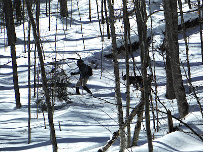
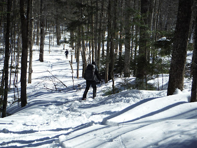
Feb 19, 2024 (Presidents Day) - We intended to ski to Puffer Pond from the Old Farm trailhead. The Puffer Pond trail leaves the E Br Sac trail & is often wet & messy especially early & late season, so we continued S for 0.2 miles to check out a newly flagged route that avoids the mess. The new route goes mostly thru hardwoods & was excellent skiing - it is longer than the direct route by 0.2 miles. Headed W on the PP trail which showed little to no recent use. At times, we had to detour to find good places to cross several brooklets. Crossed the inlet to 13th Lake on a good bridge then checked out the waterfall on HOUR POND BROOK. The trail then climbed, steeply at first*, alongside the brook, gaining 200' in 0.7 miles. Just past the junction with the Hour Pond trail, the PP trail crosses the brook but there is no bridge & it did not look safe to cross, so we stopped for lunch there in sight of the scenic brook. Headed back down & avoided the steep section by going off-trail to the S - the skiing there thru open hardwoods was fun. The often wet section of the trail was mostly well-frozen & not really an issue. Still lots of time left, so we decided to ski the BOTHERATION POND loop. Looked like quite a few skiers had done it recently. The lower crossing of the brook was no problem. Thus began a long 460' climb over the next 2.8 miles - there were some short downhills too. L on the Halfway Brook trail & mostly downhill the rest of the way. Ice on the 2 ponds was good. Mostly very good skiing on 4-6" of powder on top of a good base, some rocks still showing on the BP loop. 11.5 miles, 1056' el gain/loss, 6 hours.
June 2023 - New owners of Cabins at Chimney Mountain on Kings Flow. The property now offers access to State trails to Chimney Mountain & Puffer Pond for a $10 parking fee. Hikers are requested to stay on the trails and to respect renters and owners of the property.
Mar 7, 2023 - $5 for parking at the Chimney Mtn cabins, no other cars. Skied S along the trail on the E side of Kings Flow for over a mile - snowshoe tracks until Carrol Brook, then we were on our own, breaking trail on 20" with breakable crust (there were some non-crusty powder sections). The blue trail then pulls slowly away up from the flow & down to the red trail. L on red & a slow gentle to moderate climb on the scenic Puffer Pond Brook Trail (also part of the North Country National Scenic Trail). Stream crossings had decent snow bridges. Stopped at the lean-to for lunch - the last log entry was from 12/21/22. Headed out onto the pond with a view of Bullhead Mtn's "head", & over to the eastern lean-to - this one leans more than necessary. Headed back on the pond with a view of Puffer Mtn. Quite windy. Nice ski back down in our tracks, some care was needed on steeper sections. Temp ~20F, mostly cloudy, snow showers. Elevations 1,725'-2,225'. Saw no one. 8.5 miles, 5 hours.
June 27, 2022 - Over 1" of rain fell late night/early morning but skies cleared by 10am. Started at the N end of Kings Flow (1,709') on private land & cabins - $5 charge to park (also the trailhead for Chimney Mtn). Started hiking to the R of the sign-in kiosk, the trail reaches state land (Siamese Ponds Wilderness) in 0.3 miles. Thrush sings in the woods. A beaver pond is then seen on the R, soon after, we crossed Carroll Brook. Started gaining elevation - moderate grade. After gaining 650', the trail dropped down to PUFFER POND (2,185') & the North Country National Scenic Trail (NCT, a 4,800-mile trail that goes from VT to ND). Stopped at the west lean-to (has an outhouse) for lunch. Trailless Puffer Mtn (3,472') is seen across the pond. Headed over to the east lean-to which has a slightly better view but I believe DEC wants to remove it - it needs some maintenance, & I did not see a privy. Back past the W lean-to & down the Puffer Pond Brook trail, which became an official DEC trail (red DEC + NCT markers) not too long ago - I have skied (easy intermediate) it a couple times a long time ago before it was marked - it mostly follows an old road. Many lovely cascades on the brook. Big pine with a small plaque. After about 1.5 miles from the pond, the NCT & red markers turn L & cross the brook - we bear R on the blue trail, up then down, to Kings Flow. The trail then heads N with some views of the flow but generally just out of sight of it. Tricky crossing of Carroll Brook. End at grassy field at the cabins. Temp ~70°F & breezy - great hiking weather. Saw no one, very peaceful at the pond. Light mosquito activity early & some ankle-biters at the parking area, but most of the trip was bug-free. Some wet & muddy spots - but it is Adirondack hiking so what do you expect, especially after rain? Doe & fawn, red efts, snapping turtle, osprey. 6.2 miles, 5.2 hours.
.JPG)


.JPG)
.JPG)
.JPG)
.JPG)
.JPG)
.JPG)
.JPG)
.JPG)
.JPG)
.JPG)
.JPG)
.JPG)
.JPG)

.JPG)
.JPG)
.JPG)
.JPG)


Comments
Post a Comment