WINDING (aka PA'S) FALLS, BOG RIVER xc skiing

Jan 6, 2013 - PA'S FALLS ON THE BOG RIVER. 20" - much powder over a wettish base. Bridge over Round Lake Stream. S of the bridge an old road passes the sites of the "Bog River Hilton" & other camps that the state removed soon after purchasing the land eventually reaching a gate at the edge of state land - some blowdown. NW of the bridge an old road (now also canoe carry for those doing the Whitney Loop) goes up over a hill for 2 miles before reaching the bridge over the Bog River. Crossed the bridge & skied downstream a bit to the spectacular falls - lots of water dropping over 20' between icy rock walls. 6+ hours.
Dec 30, 2007 - PA'S & SPLIT ROCK FALLS, BOG RIVER on unmarked trail from Rt.30 (0.2 miles S of Rt.421). 20" in the Tupper Lake area - bit of an icy crust made for more challenging skiing. 1.5 miles on rolling hilly terrain, soon reach Bog River then follow Round Lake Outlet. A R on dirt road goes over a good bridge, bear R long uphill then drop to cross bridge over the Bog River - a R turn leads to best spot to enjoy noisy Pa's Falls which drops 30'. From bridge continued on old logging road, bearing L then turning L (following orange ribbons) & reach 6' Split Rock Falls in 10 mins. The river upstream is calm - pretty spot. The camps we saw last year have already been removed - area was recently purchased by the state. Lots of deer tracks. Intermediate. 7.5 miles, 5 hrs.
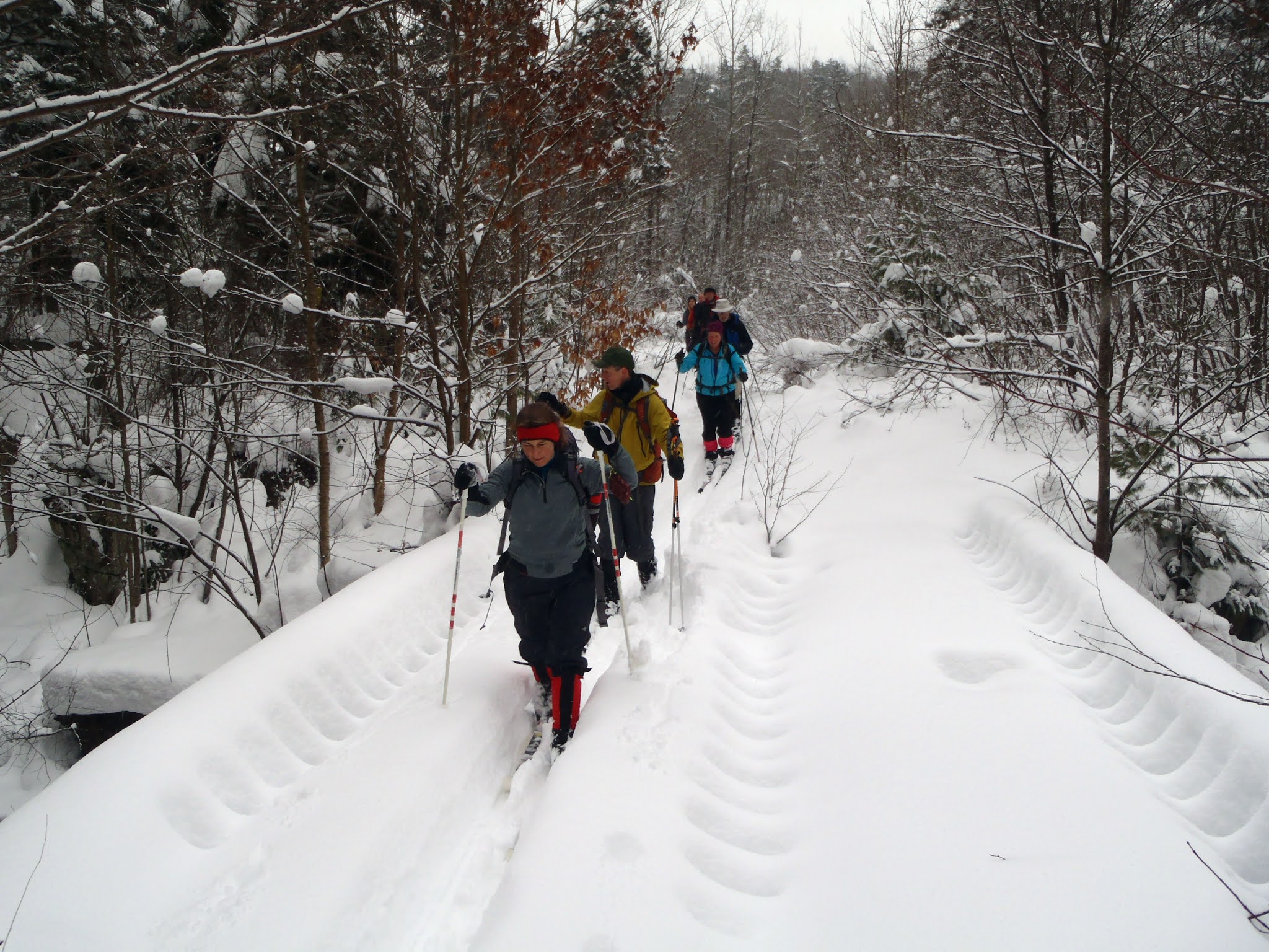


Jan 28, 2007 - PA'S FALLS on the BOG RIVER skiing, S of Tupper Lake. New state land in the Round Lake tract. From Rt.30 drive SW on Circle Rd about half a mile until you see a gated dirt road on R. 8" powder on icy base - very good skiing - couple of snowmobiles went in to camps so no breaking trail. Camps will be removed by 2008 & area may be designated "primitive". A network of dirt (shown on the Little Tupper Lake USGS map but not on most other maps - we have the USGS map in stock at APnP) & logging roads offers novice/easy intermediate skiing. From gate we go less than a mile & take a R (sign says Bog River Club). Road continues over gentle to moderately rolling terrain thru small hardwoods. After ~3 miles from gate Round Lake Outlet is seen on the left, soon cross it on a good bridge. Up & away from the stream & soon take a R. Trail/road now climbs for while before narrowing a bit past a gate & dropping to a very good bridge over the Bog River. Cross bridge, take a R & ski on river L for 150' to a wonderful spot next to Pa's Falls which drops 30' in 3 tiers - ice & snow clung to the evergreens - what a wonderful destination! Uncovered 3 placques memorializing Pa/Dad. 11+ miles, 5.5 hours. Karhu Pinnacle skis have very nice glide.
Feb 19, 2006 - PA'S FALLS on the BOG RIVER near Tupper Lake. 2"-4" powder on variable base. 1st 1.5 miles on unmarked old logging road from Rt.421 - rest was bushwhack It was a looooong 1.5 miles further to get to the falls over rough terrain. 30' falls in 3 drops - lots of brown tannin-rich water gushing between rock walls - ice clung to nearby rock & vegetation - an awesome sight & worth the work to get there. A short distance above the falls is a good bridge & an old dirt road comes in from the Round Lake area - this should be state land in the near future & should offer an easier 11 mile round-trip route to the falls. Decided to return up & away from the river to see if it was any easier (no). Found a hunters' path marked with ribbon but it went N & W & I abandoned that idea after going too far. 7.5 miles, 6 hours.


Comments
Post a Comment