DUNVILLE HOLLOW hiking & skiing in Woodford VT


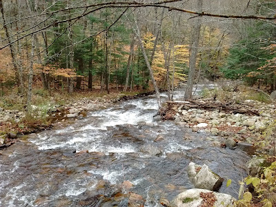
Oct 31, 2018 - From parking area on Dunville Hollow/Notch Rd (1,470' el.).  Green Mountain National Forest.  Walked up the road & took a R immediately after crossing the bridge over Stamford Stream which meets City Stream just downstream of the bridge.  Continued to the R of fence & house, looking like someone's backyard but soon see the continuation of unmarked Forest Road 75, a not-too-old woods road in this section.  Beech trees like to hold onto their leaves but it seemed even more-so this season showing some bright yellow-green & shades of gold.  Stamford Stream is never too far and is constant rapids & cascades - very scenic.  Gentle uphill grade.  After about a half mile the old road is washed out but it was not too hard to get past, just a little muddy & wet (the road is officially closed).  After ~1 mile crossed the stream which is at the bottom of the Dunville Downhill (see below).  ~2 miles, passed 3 houses, each with its own moose.  Took a R at 2.5 miles going past a camp - trails gets steeper.  An old Pennzoil can hangs on a tree just before the junction with the Old Stage Trail.  The latter soon crosses a small stream then Stamford Stream, both of which would have been a wet crossing at this time - a nice gentleman in an UTV pulled up & offered to take me across - he would return in an hour or 2 - after a little thought I declined his offer due to the possibility of rain later in the day.  Instead I went off-trail to the W to a large clearcut over a couple hills (~2,150') & stopped for lunch at a fire ring - there is so much slash that I would think a campfire would have a great chance to spread over the whole hill!  Views to Glastenbury & Prospect Mtns.  Spotted a whitetail buck.  Back on FR 75.  4.2 hours.


Jan 21, 2017 - GREEN MOUNTAIN NF ski, Woodford VT.  Started out on FR 273 again.  Foggy.  After the 3rd crossing of Prospect trails we took a R & went a short distance on an old trail to find the "Dunville Downhill" sign (in good snow conditions it is a great run down to Dunville Hollow from here).  Back to FR 273.  At 2.5 miles took a L on trail toward Heartwellville going past a camp.  In an exploratory mood, at 2,300' we decided to bushwhack N - pretty nasty going thru hobblebush & baby beeches.  Reached a steep trail @ over 2,400' & stopped for lunch.  Took that trail steeply down to another camp then another trail N (no markers on any of these trails in here).  Passed another camp & looped back to FR 273 on Prospect trails.  Without trying, I think we hit every private inholding in the area.  Good skiing, a bit mushier than yesterday, temp rising thru the 30s into lower 40s.  4+ hours.


Jan 28, 2013 - DUNVILLE HOLLOW.  Parked on Notch Rd off Rt.9 just E of Bennington VT.  Variable conditions.  FR 75 from end of road (just to the R of a residence) - nice skiing climbing gently alongside scenic Stamford Stream.  Soon find out that this forest road is closed even to foot traffic - a section is washed out thanks to Hurricane Irene - we took off skis & carefully got past by grabbing ahold of vegetation, if you slipped on the ice you could be down the creek!  Half way up the road we passed 3 "camps" & see a couple of moose ;-)  Light snowmobile use from here (none today, good skiing) up to a junction at 2.5 miles.  Turned R past a camp & climbed with Stamford Stream still down to our R.  Next R on Old Stage Trail (poor coverage on hills, stream crossings ok, rocks, needs more snow).  L on unmarked path (good) which led us to Congdon Shelter on the AT/LT.  After lunch headed N on the AT/LT (poor, hit too many rocks) & past the junction of Old Stage Trail, stopped at a steep uphill well before Harmon Hill.  Decided to go back down off-trail (very good to excellent) finally reaching the Old Stage (poor on the downhills) which we took back down with a couple of off-trail side-trips (excellent) for turns.  Did a short loop over to FR 273 before heading back down.  850' elevation change, 5.2 hours. 


Mar 8, 2010 - APPALACHIAN & LONG TRAILS from Dunville Hollow.  Lots of snow, 2'+ above 2,000', hint of iciness at first but softened up as temp got well above freezing.  Park car on Notch Rd off Rt. 9 E of Bennington.  Lightly used snowmobile trail alongside Stamford Stream.  Moose at couple of camps.  Breaking trail from now on (only sink in 3-4").  Old Stage Trail across 2 streams (iced over) then unmarked trail L to Congdon Shelter.  N on AT/LT to 2,560' hill.  Would like to have reached Harmon Hill but ran out of time (lost trail for a while) - next time.  Whitewater skiing on Stamford Stream on way back.  9.5 miles, 5.5 hours, 1,100' elevation gain/loss. 


Mar 16, 2009 - DUNVILLE HOLLOW & the "DUNVILLE DOWNHILL", Woodford, VT.  Excellent conditions as sun had softened the surface - area is mostly hardwoods.  Parked on City Stream Rd just off Rt.9.  Out on Forest Road 273, a snowmobile trail.  Crossed 3 trails of Prospect Mtn Ski Area then R "off-trail" heading W.  Soon found an old logging road going in our direction, then another one R or N up unnamed 2,315' hill.  Turned around, enjoying the downhill then R or W on original old road & down along stream that dumps into Stamford Stream in Dunville Hollow after 650' drop from our highest elevation - exhilarating!  Looped the long way back on snowmobile trails.  3 hours. 


Comments

Popular posts from this blog

BOREAS PONDS in the Adirondack Park

WAKELY MOUNTAIN fire tower hike

JESSUP RIVER & INDIAN LAKE CANOEING