Posts

Showing posts from June, 2023

THIRTEENTH LAKE paddling & camping
Image
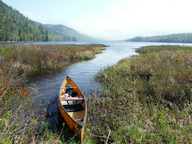
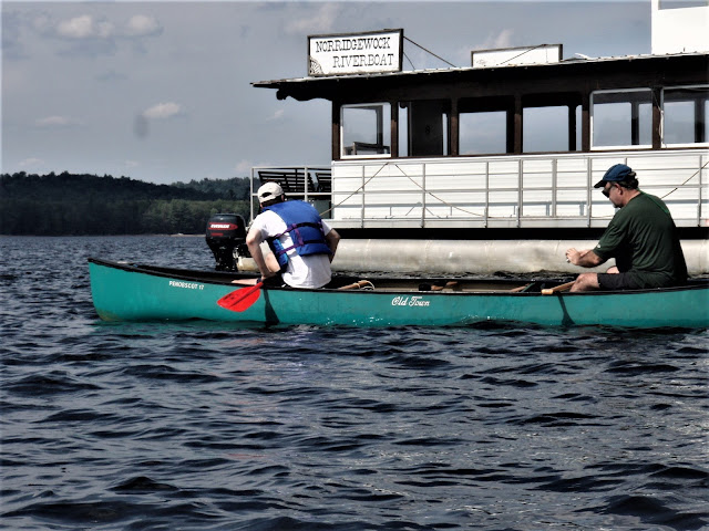
  In New York State, anyone in a boat under 21' (includes canoe, kayak, SUP, rowboat) must wear a life jacket from Nov 1 thru May 1 - in warmer months it must be readily available. Children under 12 years of age must wear one at all times. So... On April 23, 2019 at Thirteenth Lake in the Adirondacks, with some ice still on the surface, I see these... 5 people not wearing life jackets, including kids! 2019 - THIRTEENTH LAKE hiking & camping - warm days with a fair amount of sun, no snow. April 21, Easter Sunday - walked down the W side of the lake (elevation 1,675'), which still had ice over 90% of its surface, passing 2 bc campsites, then turned NW on trail toward Peaked Mtn Pond -several wet spots on marked trails, but not too muddy. Peaked Mtn Brook had many nice waterfalls thanks to high water. A brook crossing would mean wet feet. From brook crossing, bushwhacked E up LITTLE THIRTEENTH LAKE MOUNTAIN - mostly open hardwoods & dry underfoot. Got a peek at Pea...
LAKE PLACID paddling

Image
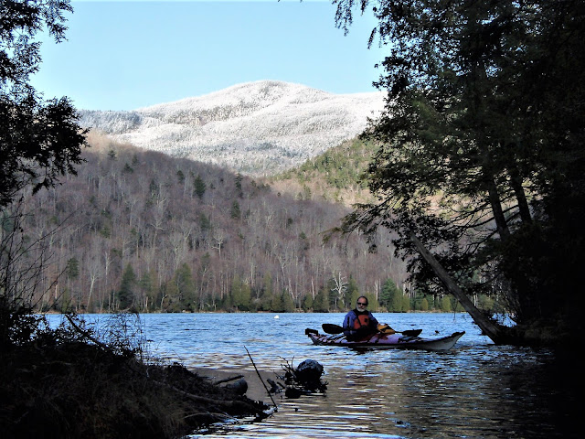
  Sep 23, 2002 - Lake Placid kayaking. 7th largest Adirondack lake. Put-in at the state launch off Mirror Lake Dr. Much cooler today, the first day of fall - wear the Stohlquist Splashdown top most of the time. Maples well on their way, beeches & birches just starting to turn yellow - peak color should be in about a week. Headed up along the E shore about 3.5 mi. to Whiteface Landing in Barrel Bay. Can hike the trail up Whiteface Mt. (in constant view from the water) from here. A picnic spot with fireplace (no camping) is littered with Bud cans (you never see cans of Young's Double Chocolate Stout or the like littering the wilds - Bud & Coors drinkers are the biggest offenders). A duck keeps popping up near me - I suspect it's looking for handouts. Continued counterclockwise staying close to shore. Many fancy summer homes of the rich & famous (N end of lake is least developed). From the SW corner I turn back NE & explore the 2 major islands: Moose & Hawk. St...

STILLWATER RESERVOIR & RED HORSE TRAIL paddling

Image
  July 2023 - DEC Region 6 Operations staff in Lowville recently rehabilitated the Stillwater Reservoir docks in Herkimer County. The existing docks had deteriorated with age and significant use and needed to be repaired to ensure public safety and access as the boat ramp is the only location for launching of trailered boats on the reservoir. The Stillwater Reservoir is a 6,700-acre waterbody located in the western Adirondacks and is a popular destination for motorboating, paddling, and fishing. Forty-six first-come, first-served primitive campsites are located on islands and along the reservoir shoreline, including two accessible sites. The Peaked Mountain Pond Trail, Red Horse Trail, and Wilderness Lakes Canoe Carry Trailheads can all be accessed by boat from the reservoir. Aug 12 & 13, 2006 - STILLWATER RESERVOIR canoe camping.  One must choose an available backcountry campsite when one signs in at the register.  Most of this large lake is state land.  For us,...

UPPER ST. REGIS, SPITFIRE, & LOWER ST. REGIS LAKES paddling

  Sep 14, 2003 - LOWER ST. REGIS, SPITFIRE, UPPER ST. REGIS LAKES kayaking. Put-in above outlet dam on Keese Mill Rd opposite parking area for Jones & Black Ponds. Despite threat of showers in the forecast, we got ourselves a mostly sunny & warm late summer day. Paddled up the 2 mile long W arm (Main Branch of St. Regis River) of Lower St. Regis Lake & soon see an osprey & a deer - this is a very scenic section to start & end the trip. Out on the main lake Paul Smiths College stands out to the NE. A wide channel with boggy shores leads into Spitfire Lake. St. Regis Mtn stands clearly to the W. Passing Rabbit Island (site of a Trudeau TB experiment) a short channel leads into Upper St. Regis Lake. We go to the E of Birch Island to stay out of the wind. Stop at the carry to Bog Pond for lunch - not many places to rest on this trip because much of the shoreline is private. Many fancy camps are passed - most are reasonably tastefull & blend into the woods well. ...

SACANDAGA LAKE & BURNT PLACE BROOK paddling

Image
  Aug 22, 2016 - SACANDAGA LAKE, BURNT PLACE BROOK, MUD LAKE, HATCHERY BROOK from far end of Moffitt Beach State Campground, there is a good launch spot between campsites 247 & 248.  Temp in the 60s.  Crossed SL with a headwind, N end of the lake has much state land, some nice piney shores & sand beaches.  Soon hit a 2' beaver dam on BPB.  1.4 miles along the narrowing brook to Mud Lake, passed an empty osprey nest atop a dead tree, view of Pillsbury Mtn, wood ducks. Went  0.4 miles further on BPB above ML, wide at 1st but narrowed a lot & got shallow.  Back to SL - had to get out for 5 beaver dams & scootched over 8 more small ones.  Up HB, over 1 beaver dam & turned around at a 2nd after going <1 mile winding thru a large vly - lots of gb herons here.  Flowering: buttonbush, virgin's bower, fragrant water lily, yellow pond lily, turtlehead, goldenrod, pitcher plant, cardinal flower, pickerelweed, aster, purple loosest...

CHENEY POND & BOREAS RIVER paddling

  Aug 17&18, 2014 - CHENEY POND & BOREAS RIVER.  Half mile drive on a very rough dirt road, good clearance needed.  Newish lean-to above sandy beach on E shore of CP.  Water level high so I was able to run the short channel to BR without getting out of the canoe.  Going downstream there is a short easy (if you take the inside of the bend) rapid, river is 30-50' wide.  Quarter mile further & I found a nice spacious campsite with picnic table on river R, good view too (North River Range, Marcy & Haystack).  Lots of flowers.  Paddled down to the old Lester Dam, got out & explored the rapids below, view N to High Peaks.  Upstream 2.5 miles to rocky rapids then back down to camp.  Very little wildlife in the afternoon but had 2 garter snakes in camp & heard a white-throated sparrow in the evening.  In the am heard loons flying, chickadees & a hummingbird flew by.  Minimal bad bugs - mostly no-see-ums - no...

WEST & CANADA LAKES paddling

Image
  Aug 8, 2004 - CANADA LAKE kayaking. Had to change my plans for the day after spending 15 hrs. at the hospital with little sleep after Waygassy got a fishhook stuck in his eye - wish he would spend more time on safe activities like whitewater kayaking! Put-in at small state launch on Sawdust Creek (West Lake Rd). Started at 4:45pm, took out at 8:30pm after watching sun set over West Lake. Negro/Mud Lakes outlet, Lily Lake. Several whitetail deer. Bit too much development & motor traffic on Canada Lake proper for this paddler so searched out some quieter spots. Dagger Exodus 16.8 would be one of my last choices for beaverdam hopping but we went over several as we pushed thru the narrow Negro/Mud Lakes outlet. The Exodus tracks better & is harder to turn at higher speeds (4mph+) but at lower speeds tracking is only good but turning is much easier. Fair amount of weathercocking & I needed the rudder in the wind while heading out over the open water. May 26, 2001 - West La...

LAKE CHAMPLAIN paddling

Image
  Aug 9 & 10, 2009 - LAKE CHAMPLAIN.  Checked in to Ausable Point State Campsite & got the last on-water site at the mouth of the Ausable River.  20 knot winds from SE produced surf at the campsite.  From the Dead Creek parking area just outside the entrance booth paddled out onto the lake (N facing & out of full wind) & up the Little Ausable River for over a mile until downed tree.  Back & then carried across road to Dead Creek, a great spot for poking around in thru lily-pads & grasses enjoying the plants, wildlife & distant Adirondack mountain views; ospreys & nest; tons of wood ducks; swamp maples turning red.  Back at our campsite we were entertained by 2 guys in an aluminum canoe coming out of the river into the lake waves.  They got around the 1st point into the waves ok, turning to go downwind looked good & it looked like they were surfing.  For some reason they turned sideways to the waves & over th...

COD POND & STEWART CREEK canoeing & camping

Image
  July 3 & 4, 2016 - COD POND, LITTLE JOE POND, STEWART CREEK.  1 mile hike to Cod Pond (doubled the carry, so 3 miles for me) - gain of ~200' in 1st half, quite a few downed trees & blowdown makes the trail hard to follow close to the pond.  Camped on Cod Pond which has a lot of watershield growing in it.  Hiked to Little Joe Pond (part bushwhack SSW, part on unofficial trail).  Paddled upstream on Stewart Creek - got out for 4 beaver dams in 1st couple of miles, then 0.2 mile carry (rock-hopped then bushwhacked to Oregon Trail - nasty), then 3  more beaver dams in next couple of miles past North Bend & Oregon Trail bridge.  Creek as wide as 50' up here; turned around at foot of another rocky rapid.  Lovely scenery.  Went further on Oregon Trail on the carry on way back to a wet section then bushwhacked down thru woods then wetland marsh to a spot on the creek ~100 yards downstream of the rapids. Broke camp & out.  Some ...

MAIN BRANCH ST. REGIS RIVER paddling

  July 15/16, 2000 - Main Branch St. Regis River (see below for directions.) Back for an overnighter; brought the Dagger Reflection 16 for its all-aroundedness - not too heavy (60lbs.), good primary (160lb. son of N. can stand up in the bow) & secondary stability, good combination of tracking & turning ability, durable for some whitewater, reasonably fast boat. Wheeled canoe into Indian Rocks put-in; spotted cars downstream 4.2 miles west on dirt road. Paddled to campsite & set up tents & tarps. After lunch paddled upstream past put-in & were soon into private land on both shores. Started to rain lightly but didn't really bother us much. Shores varied from grassy marsh to boreal forest (white pine, tamarack, cedar, spruce). After about 2.5 hrs. going at 2.37 mph (thanks to GPS companion), with views of St. Regis Mtn. to the east, river widened & became pond-like; saw 1 loon here, nice hilly tall pine shores. Downstream return only took 1.5 hrs. Some drizzle ...

LONG LAKE paddling

Image
Apr 30, 2016 - Long Lake canoe camping.  Lousy weather forecast - rain & temps 40-45F - so more camping than canoeing.  Left the boat launch in Long Lake Village in a light rain - felt comfortable & dry inside in an aquashell wetsuit, semi-dry top & pants plus neoprene gloves & mukluks.  Did not care for the leantos at Catlin Bay (too much civilization in view) & Hidden Cove so pushed on to Kelly Point.  5.7 miles in 2.1 hours.  Lunched then hung out in camp the rest of the day.  Did not rain most of the afternoon & when it did I kept the fire going by building a roof over it.  A mouse showed itself early so kept a watchful eye on the food.  Kelly Point, a scenic spot, has 2 leantos just 100' from each other.  Saw 3 motorboats go by all day; one towed a canoe.  Barred owls & loons called out at night.  Dry in the morning so got an early start out.  Poked up Big Brook 0.8 miles to foot of rocky r...