BOG RIVER - HITCHINS POND canoeing. Adirondack Park.

The gate on the access road leading to the Bog River Dam, also known as Lows Lower Dam, is closed to allow for dam maintenance. The Lower Dam Road and parking area near the end of the road will be closed to public use for the duration of the construction project. Access to the site by water is also prohibited.
Construction activities are expected seven days per week and is anticipated to continue through fall 2024. The project will bring the dam into compliance with New York State dam safety regulations.
More Info.


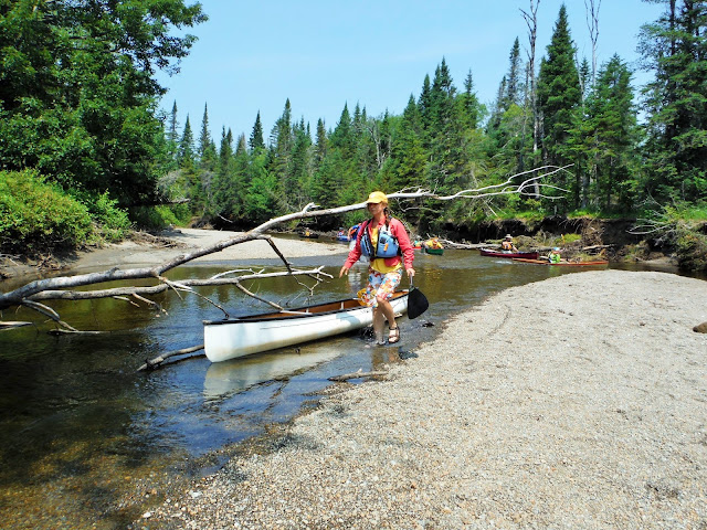
Aug 16, 2010 - BOG RIVER from Lower Dam to Bog River Falls. A couple of thunderstorms passed thru early while we were in camp but rest of the day ended up real nice - had time to solo (using kneeling thwart) the kevlar Bell Northstar canoe & explore the N end of Hitchins Pond. Dropped off camping gear at the cars & spotted a car at Bog River Falls on Rt.421. In contrast to yesterday's route this section will need a few years to see a 100 paddlers, we saw no-one. The river has mostly wooded shores - mainly alders & spruce but also some very tall white pines & some hardwoods. From the dam we carry on river R past the powerhouse to the flat water below. All carries after this are on river L - expect to step over logs, etc. Soon come to a short rapid which we lined. At the next & longer rapid a rough carry trail well-marked with ribbons goes steeply up before leveling out somewhat. Ceebotar & Oceebota had a royalex canoe & decided to line instead of carry. The next carry starts above Split Rock Falls, rough at first it soon takes a R on an old logging road which leads to an old bridge. I have skied much of this area & am somewhat familiar with the paths. From the bridge the carry continues alongside the river passing a campsite & soon bears L at a red marker to the pool below Pa's Falls. Bearing R at the fork leads to the best view of the falls & is a great spot for a break. Here the river drops & turns R shooting down thru vertical rock walls, the roar of the water makes it difficult to carry on a conversation - a great spot. After a short paddle across the pool there are 2 shorter carries (not as well-marked, stay close to the river). Good stretch of flat water follows & a sign for the Bog River Ski Trail is seen on the L. We go over a couple of beaver dams. We almost miss the start of the next & longest carry which follows the ski trail with views of the river. Eventually the ski trail turns L along an old logging road while the carry trail jogs L & R. Occasionally could not see the next ribbon & the path is little used so one has to pay attention so as to not get lost. We arrive at the river just above the confluence with Round Lake Outlet. Flat water for last 1.75 miles to take-out. 5.4 hours for the trip from the Lower Dam to BR Falls. No bad bugs except for a few mosquitoes in camp.
Aug 15 - BOG RIVER, HITCHINS POND, LOW'S RIDGE from the Lower Dam. This is a paddlers' superhighway - probably saw close to 100 other paddlers (half canoes half kayaks, motors not allowed) either coming or going (most headed to & from Low's Lake). Most campsites early on on the Bog River & Hitchins were available mid-day Sunday & we chose #4 because it has room for 3 tents & it is away from the traffic. Paddled over to start of the Upper Dam portage. From there it is ~1.25 mile hike to the lookout on Low's Ridge - great views of the Bog River & distant High Peaks from the open rocks. Loons, black ducks - others saw a bald eagle & a swimming red squirrel.


Comments
Post a Comment